

First Responder Drone Software Company Introduces Tools for Tactical Missions
Law enforcement can use this tool for a number of situations when they need actionable intelligence, including assessing a disaster scene, searching for missing persons, conducting tactical operations, tracking a criminal suspect or monitoring large-scale events. It is compatible with any type of drone.
SkyeBrowse, a company that makes drone software for first responders, has launched Midnight Sun, a new tactical tool that helps identify unknown objects or people in the path of a drone’s flight.
“As we continue to develop SkyeBrowse for first responders and armed forces, we have found that what they need most is real-time, actionable intelligence during tactical missions,” said SkyeBrowse Co-founder and CEO Bobby Ouyang. “Modeled after the heartbeat sensor and Advanced UAV in Call of Duty, Midnight Sun helps tactical teams quickly identify unknown objects in a particular area, assess their threat level and make informed decisions.”
The new tool adds to SkyeBrowse’s proprietary technology, which uses videogrammetry to create 3D models from drone video. Using Midnight Sun while flying a drone mission, the supervised machine learning algorithm identifies unknown objects within the flight path, sends data from the drone video to the cloud system, and labels them on a 2D map or 3D model. Incident commanders and operators can view the 2D map or 3D model in real time from a web browser or mobile phone, giving them enhanced situational awareness.
Law enforcement can use this tool for a number of situations when they need actionable intelligence, including assessing a disaster scene, searching for missing persons, conducting tactical operations, tracking a criminal suspect or monitoring large-scale events. It is compatible with any type of drone.
For full situational awareness, incident commanders can use Midnight Sun in tandem with recently launched TacBrowse, which can track tactical team members within a 3D model in real-time when they sign into a mission on the TacBrowse mobile app.
Visit skyebrowse.com/midnight-sun for more information.
About SkyeBrowse:
Designed by first responders for first responders, SkyeBrowse allows anyone to make a 3D model at the press of a button. With over 10,000 accidents documented on their CJIS-compliant servers, the Texas-based company is trusted by agencies such as the Los Angeles Port Police, Houston Forensics Science Center, the New York City Fire Department, and many more. Learn more at www.skyebrowse.com.
More Technology
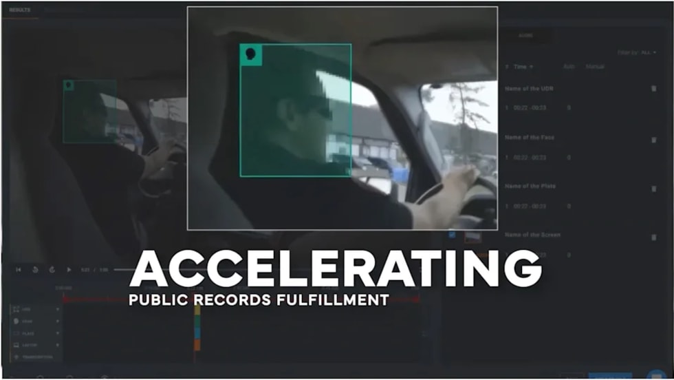
CHP to Accelerate Evidence Redaction & Public Records Fulfillment Through Veritone Redact
With Veritone Redact, the California Highway Patrol can redact video, audio, and image-based evidence, reducing time spent on evidence preparation and public record requests.
Read More →
Echodyne Expands Public Safety Radar Applications Through Partnership with Axon
Echodyne has partnered with Axon to support safer and more scalable drone operations across law enforcement, homeland security, and Drone as First Responder programs globally.
Read More →
Miami Police Department Deploys Airwayz’s Overwatch Platform During FIFA World Cup Events
The deployment of Airwayz’s Overwatch airspace management platform during the FIFA World Cup demonstrates the future of airspace infrastructure for managing, securing, and coordinating complex urban airspace environments.
Read More →

How Patrolfinder Uses Data to Make Streets Safer
Law enforcement agencies have long relied on instinct and routine to optimize patrols. Patrolfinder uses data to help agencies see where officers go — and where they don’t — to improve visibility and maximize coverage.
Read More →
Crime Prevention by Merging Tech with Human Intervention
Elite Interactive Solutions tackles crime prevention with technology and human intervention, working closely with local police to provide insights when a response is needed. The key is to blend the latest in remote video monitoring, artificial intelligence, and a well-trained agent with eyes on the scene.
Read More →
Case Study Details Integration of Body-Worn Cameras with CAD
The Billerica Police Department (Massachusetts) improved transparency and accountability, sharpened evidence management, and reduced manual hours by integrating Axis Communications body-worn cameras with its Computer-Aided Dispatch (CAD) system.
Read More →
ZeroEyes Public Safety Alerts Integrates Samdesk for Real-Time Risk Detection and Awareness
ZeroEyes has integrated Samdesk into its Public Safety Alerts platform to deliver faster, verified intelligence to help organizations understand emerging risks and respond quickly.
Read More →
NJ Police Department Combines Strong Technology & Public Safety Strategy
The Fort Lee Police Department in New Jersey has modernized with Genetec Security Center, including video management, automatic license plate recognition (ALPR), and Clearance digital evidence management.
Read More →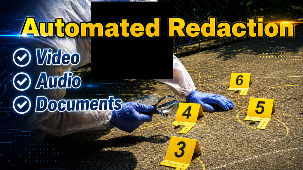
Pimloc & Dynamic Workflow Solutions Partner to Deliver Data Management and Automated Redaction
The joint redaction solution from Pimloc and Dynamic Workflow Solutions helps agencies reduce FOIA response time and compliance risk by automatically redacting faces, license plates, and other sensitive information from digital evidence.
Read More →
The University of Alabama Rolls Out Couter-Drone Technology
The University of Alabama is using D-Fend Solutions as a counter-drone technology supplier for campus and game-day airspace security. The University integrates D-Fend’s EnforceAir into its Emergency Operations Center (EOC), utilizing a unified command framework to collaborate with local, state, and federal partners during major events.
Read More →