

My Technology Can...Speed Up Response to Emergency Calls
911inform’s solution provides responding officers with precise information about the caller’s location and digital maps of the building.
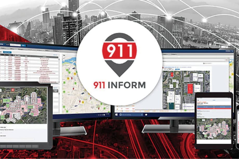
911inform provides dispatchers, first responders, and key building personnel with tools to make emergency response more effective and efficient. The software can help responders find the caller faster and sends building information to their mobile devices.
In a world where businesses have successfully navigated the transition to advanced digital communications and high-speed data connectivity, the Internet of Everything (IoE) has swaddled the public in a warm hyperconnected blanket of assurance regarding 911. Arguably though, a dichotomy still exists between the technology used by the general public and that used in public safety networks designed to protect the same constituents. Thanks to TV dramas and movies, those looking in from outside the industry are sheltered from the fact that, most often, these critical resources remain in the proverbial digital Dark Ages.
Enhanced 911
Since Feb. 16, 1968, when the first 911 call was made in rural Haleyville, AL, the technology used to reach emergency services has remained mostly unchanged. While there is general caution behind not deploying unvetted life-safety technology on citizens, a happy medium must be found, allowing safe innovation to evolve.
For example, the capabilities of modern IP-enabled next-generation 911 services (NG911) provide a new digital superhighway, allowing intelligent information to reach public safety. This opens the door for additional situational awareness on emergency events, whether it’s an emergency 911 phone call, a press on a panic button, or an intelligent Internet of Things (IoT) sensor indicating a dangerous condition like smoke, fire, or even a chemical odor.
Today’s current E911 technology challenge begins with the network itself. The aged analog architecture was designed and built with the available technology over five decades ago in the 1960s before modern digital networks even existed. The 911 system was a purpose-built, siloed solution. Its purpose was to enable a single, easy-to-remember three-digit short code—911—routing a caller to local emergency services based on the device’s location. The thought of delivering any additional data, be it caller location or situational awareness, didn’t exist at the time.
However, location information was still important. The location problem was solved in the 1980s by correlating the device location based on the device’s phone number. Hence the addition of “Caller ID” in the telephone network. Since devices typically remained at a single, fixed location, as user mobility wasn’t an option, this allowed the caller’s address information to be reliably obtained through a reverse number lookup function. Problem solved This network enhancement provides the “E” in the E911 system that remains in place today.
Problems with the Cloud
One thing that is very different today on E911 is that the cloud is often utilized to support centralized communications infrastructure and provide a convenient work-from-anywhere environment supporting multi-line telephone system (MLTS) users. The one downside of this architecture is that telephone trunk lines are no longer physically local to the caller. Unintentionally, and usually unnoticed, this change often impacted 911 calls by routing them to the wrong Emergency Communications Center (ECC) as well as delivering incorrect location reporting to first responders.
The MLTS no longer understood where a user was located and had no way of communicating that information to the E911 network. This issue was compounded by nomadic callers moving to other facilities where they likely didn’t know their street address or how to effectively communicate their location within a building to an emergency dispatcher. This can add precious minutes to the call and response. Over the years, several incidents occurred but were often dismissed as a glitch in the network. No one took the time to understand what occurred, and incidents were explained away with technical jargon that few would understand. Over time, the stories would fade into folklore, leaving the cause dangerously buried within the systems.
Looking deeply at the problem, the issue was not collecting location information. The challenge was getting the information into the public safety network in real time. The archaic method of correlating phone numbers to fixed locations in a public safety database worked well when the world did not have the nomadic device and number mobility afforded to us today. The databases in place had an update window of 24 to 48 hours, allowing users to move hundreds or thousands of miles before any updates were applied.
Another issue is the multiple appearances of devices. With a phone on my desk at the office, and one in my home office, coupled with a “softphone” on my laptop, reporting 911 location at the user level was not sufficient. Each device needed to be tracked individually, and the current location information needed to be sent in real-time with the call. This simply was not possible with the E911 network deployed today.
The Solution
NG911 networks are quickly coming into existence in several states. Also, the federal government is earmarking $10 billion in funding from spectrum auctions for a new National NENA i3 ESINet (Emergency Services IP Network). The result is that new transitional hybrid networks are available now that allow enterprises to build with tomorrow’s technology today, sending fully compliant information into the network and allowing the network to translate into compatible information at the ECC. This allows the enterprise to send data with full resolution and not worry about delivery requirements at the ECC.
My company’s product 911inform provides a solution for the location problem. It is the only notification and emergency management solution that provides both public safety and key building personnel with the ability to manage any emergency. While the connected building platform provides emergency response teams with the bi-directional communication and controls needed to manage a crisis, saving valuable time.
Precise emergency event notifications are provided to emergency responders by delivering digital map layouts of the facility, including connected building controls for doors and video camera access capabilities. This provides the situational awareness required for any emergency events, including tactical response to active attacks.
Facilities can also become a micro-geofence location providing a notification of any emergency phone call placed within the geofenced location and notifying key building personnel of the emergency event. The solution also can provide a direct line of communication between building faculty, police dispatch, and first responders through its single pane of glass
interface.
For example, at a school in New Jersey that uses 911inform, an incident was picked up by exterior cameras on the school property, just outside of their building.
A pedestrian tripped and fell on a sidewalk outside of the school building. The cellular 911 call inside the school’s Geofence alerted internal staff who immediately responded and provided aid while waiting several minutes for EMS to arrive.
In other examples, access to door controls and video cameras allow responders internally to provide complete remote control of the facility, if desired, and coordinate with public safety to provide the quickest, most appropriate levels of response that can be quickly escalated or de-escalated as needed on a case-by-case basis. Responses can be modified in real-time as live situational awareness provides the best possible common operating picture to all responding resources.
Mark J. Fletcher is a certified emergency number professional and vice president of public safety solutions for 911inform LLC.
More Technology

Cellebrite Expands Exclusive SkySafe Partnership to Deliver Immediate Drone Detection and Airspace Intelligence for Digital Investigations at Scale
By integrating SkySafe's drone detection and airspace intelligence with Cellebrite's platform, agencies can connect real-time and historical UAV flight data with mobile forensic evidence, all in one place.
Read More →
New DroneShield Report Reveals Serious Gaps in Airport, Critical Infrastructure Counter-Drone Security
Survey results, as part of “Airspace Under Pressure: A Global Assessment of Counter-UAS Readiness Across Airports and Critical Infrastructure,” indicate that 60% of organizations say they lack legal authority to act against unauthorized drones.
Read More →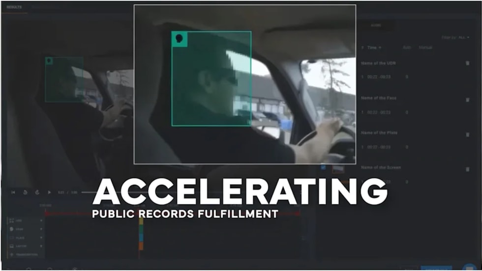
CHP to Accelerate Evidence Redaction & Public Records Fulfillment Through Veritone Redact
With Veritone Redact, the California Highway Patrol can redact video, audio, and image-based evidence, reducing time spent on evidence preparation and public record requests.
Read More →
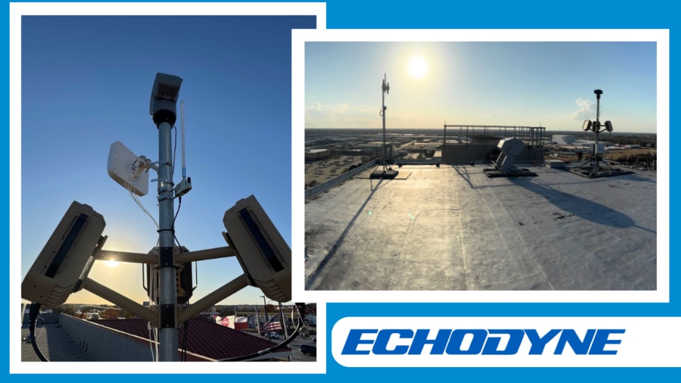
Echodyne Expands Public Safety Radar Applications Through Partnership with Axon
Echodyne has partnered with Axon to support safer and more scalable drone operations across law enforcement, homeland security, and Drone as First Responder programs globally.
Read More →
Miami Police Department Deploys Airwayz’s Overwatch Platform During FIFA World Cup Events
The deployment of Airwayz’s Overwatch airspace management platform during the FIFA World Cup demonstrates the future of airspace infrastructure for managing, securing, and coordinating complex urban airspace environments.
Read More →
How Patrolfinder Uses Data to Make Streets Safer
Law enforcement agencies have long relied on instinct and routine to optimize patrols. Patrolfinder uses data to help agencies see where officers go — and where they don’t — to improve visibility and maximize coverage.
Read More →
Crime Prevention by Merging Tech with Human Intervention
Elite Interactive Solutions tackles crime prevention with technology and human intervention, working closely with local police to provide insights when a response is needed. The key is to blend the latest in remote video monitoring, artificial intelligence, and a well-trained agent with eyes on the scene.
Read More →
Case Study Details Integration of Body-Worn Cameras with CAD
The Billerica Police Department (Massachusetts) improved transparency and accountability, sharpened evidence management, and reduced manual hours by integrating Axis Communications body-worn cameras with its Computer-Aided Dispatch (CAD) system.
Read More →
ZeroEyes Public Safety Alerts Integrates Samdesk for Real-Time Risk Detection and Awareness
ZeroEyes has integrated Samdesk into its Public Safety Alerts platform to deliver faster, verified intelligence to help organizations understand emerging risks and respond quickly.
Read More →
NJ Police Department Combines Strong Technology & Public Safety Strategy
The Fort Lee Police Department in New Jersey has modernized with Genetec Security Center, including video management, automatic license plate recognition (ALPR), and Clearance digital evidence management.
Read More →