



Faro's New CAD Zone Release 10 Software Suite Available
Faro Technologies' new Faro CAD Zone Release 10 software suite offers updated versions of Crime Zone, Crash Zone, Fire Zone, and Insurance Zone. The Release 10 versions are available for immediate delivery to customers.

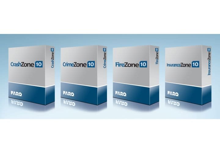
Photo: Faro Technologies
Faro Technologies' new Faro CAD Zone Release 10 software suite offers updated versions of Crime Zone, Crash Zone, Fire Zone, and Insurance Zone. The Release 10 versions are available for immediate delivery to customers. CAD Zone software is noted for its ease of use and powerful drawing, analysis, and animation tools. These software offerings enable the creation of courtroom-ready 2D and 3D drawings and animations from scanner data, point cloud data, total station data, and manual measurements.
For over 20 years Faro CAD Zone products have been the easiest and most accurate diagramming programs in the public safety market, which includes law enforcement, forensic science, crash reconstruction, loss prevention, and fire service. The Release 10 versions include even more realistic 3D graphics and faster rendering. Also included in the new releases are significant performance and feature improvements, which have been developed to help public safety customers automate their workflows.
Jay Freeland, Faro's President and CEO, states, "CAD Zone is the most trusted brand name in CADdiagramming software for the public safety industry. We have continued to invest in development to make the CAD Zone Suite of software even better. By focusing on customer requirements, Faro has developed a unique program that facilitates and simplifies the workflow required to produce courtroom-ready evidence. These enhancements improve the users' experience and helps improve their return-on-investment."
With Release 10, Crime Zone, Crash Zone, Fire Zone, and Insurance Zone now provide the following key enhancements:
Higher resolution 3D graphics for more realistic drawings and animations
Active 3D drawing functionality, with simultaneous 2D and 3D drawing windows
Faster 3D rendering rate with quicker file loading and refresh rates
Intuitive user interface for maximum productivity
Advanced graphic settings with lighting, shadow, highlights, and glass-transparency effects
Innovative satellite image clean-up tools to erase unwanted vehicles or other objects
Terrain mapping for aerial draping over 3D points
New and enhanced 3D vehicle symbols, 3D placards, and other symbology
New bullet trajectory cones with a user-specified uncertainty value
For more information on CAD Zone Suite 10, visit www.faro.com.
Faro Technologies, Inc. is a source for 3D measurement, imaging, and realization technology. Technology from Faro permits high-precision 3D measurement, imaging, and comparison of parts and compound structures within production and quality assurance processes. Faro solutions are also used for investigation and reconstruction of accident sites and crime scenes.
The CAD Zone was acquired by Faro Technologies in late July 2014. The company was originally founded in 1990 with the goal of providing CAD drawing software programs, support, and training for the law enforcement and public safety industries.
More Technology

A police agency's guide to data-driven fleet management
Costs are rising and the public expects more transparency into how their tax dollars are spent. This e-book shows how police agencies can use fleet data to take control of fleet expenses while improving officer safety and demonstrating fiscal responsibility to the communities they serve.
Read More →
AI and analytics for law enforcement: Turning data into insights
Law enforcement agencies are managing more video, sensor data and digital evidence than ever before. Discover how AI and analytics can help turn that data into actionable insights that strengthen situational awareness, accelerate investigations and support more informed decisions.
Read More →
Vasco Electronics Adds Automatic Language Detection to Vasco Translator Q1
Vasco Electronics’ software update introduces hands-free language switching and expanded offline translation across 45 language pairs, empowering law enforcement, healthcare, and front-office enterprise teams
Read More →

North Miami Police Department Deploys Mark43
The North Miami Police Department has deployed Mark43 as part of its Five-Year Strategic Plan that represents its collective vision and goals for a more proactive police department, anchored by a core commitment to leveraging modern technology to enhance efficiency and public safety.
Read More →
Cellebrite Genesis for Enterprise Now Generally Available
Made available to the public sector in June, Cellebrite Genesis is serving a growing mix of national, regional, and local agencies worldwide, including some of the largest regional and metropolitan police departments. It is now available for enterprise organizations.
Read More →
2026 Vision FirstNet Users Summit to Host Emerging Leaders Training on Grassroots Advocacy for Public Safety
“Emerging Leaders Training: Understanding the Importance of Grassroots Advocacy for Public Safety," a session during the 2026 Vision FirstNet Users Summit, will offer a roadmap for unified advocacy at the federal level.
Read More →
Motorola Solutions Completes Acquisition of D-Fend Solutions
Motorola Solutions has acquired D-Fend Solutions, an industry leader in counter-drone technology. This deal provides public safety and enterprise customers with access to advanced counter-unmanned aerial systems.
Read More →
ZeroEyes, Advantech & Camden Police Partner to Bring AI Gun Detection Technology to Delaware School District
ZeroEyes has partnered with Advantech and the Camden Police Department to deploy ZeroEyes’ AI gun detection and intelligent situational awareness platform at Delaware’s Caesar Rodney School District (CRSD).
Read More →
Leonardo U.S. Cyber & Security Solutions Introduces SignalTrace, the Next Evolution in Electronic Signature Detection Technology
SignalTrace reflects years of product refinement and a clearer expression of the technology’s purpose of recognizing and correlating electronic signatures in publicly broadcast wireless signals to reveal patterns, relationships, and trends that might otherwise go undetected.
Read More →
Pimloc Launches Secure File Sharing to Streamline Release of Redacted Video
Pimloc’s Secure File Sharing lets organizations deliver redacted video, audio, and documents through expiring, passcode-protected links, accelerating delivery while reducing security, compliance, and chain-of-custody risks.
Read More →