



Traffic and Speed Enforcement
Here you'll find a list of tools that will help you catch dangerous speeders in the act.

All Traffic Solutions
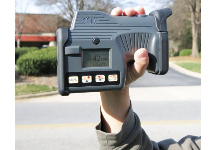
The DragonEye hand-held Lidar from All Traffic Solutions is designed to be rugged, lightweight, and easy to use for speed measurement. The DragonEye Speed Lidar features a true color, heads-up display for fast, long range operation, accurate up to 6,000 feet, while the 1-pound compact version features a true color, unity power heads-up display for rapid target acquisition up to 3,000 feet. Either DragonEye model combined with the TraffiCloud Web-Based Remote Management Service allows you to automatically upload data to optimize the enforcement and data collection process and increase data accuracy. www.alltrafficsolutions.com
Jamar Technologies
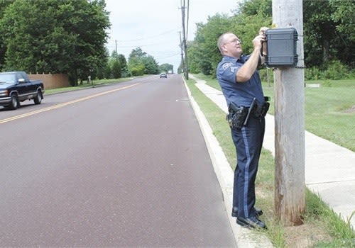
Speeding complaints are a constant. Using a Jamar Radar Recorder allows you to gather hard evidence of whether or not a problem really exists. This data can be used to find where stepped-up enforcement is really needed, or to end arguments over speeding traffic. The Radar Recorder is mobile and easy to install. It records a vehicle's speed and length, while keeping track of traffic volumes for up to two weeks at one time. www.jamartech.com
Kustom Signals
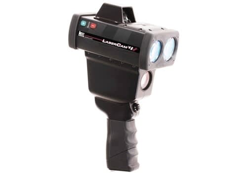
Kustom Signals has launched the second generation LaserCam 4. Powered by the award-winning ProLaser 4, LaserCam 4 offers greater range to target, faster acquisition time, and image resolution of plates at longer distances, providing a comprehensive video record of tracking history. New features include multiple speed limits to enforce different vehicle classes and different approaching and receding target speed limits, video and new customizable Photo Mode for flexible and efficient evidence management, Wi-Fi file transfer, AES 256 encryption, certification notification and management, IR emitter, and an upgrade to 64GB video memory for 33+ hours of continuous video. www.kustomsignals.com
Laser Technology Inc.
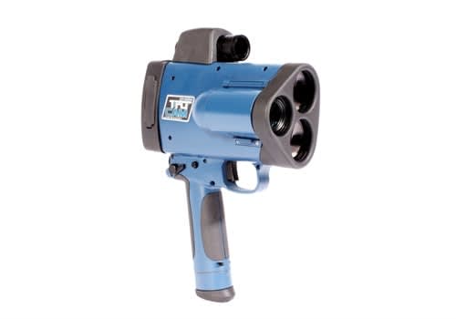
LTI has integrated a laser with a digital video camera in its LTI 20/20 TruCam speed enforcement tool. This all-in-one handheld laser-based video and photo camera collects and stores a complete chain of video evidence for both speeding and tailgating, along with a high-resolution image that identifies vehicle make, model, and license plate number as well as facial characteristics of the driver. The data it produces can feed into any GIS framework. Now with the Wi-Fi TruLink module, the TruCam offers the ability to send speed information and a photo of the license plate wirelessly to a printer in the field, making it possible for officers to present offenders with a roadside visual of the infraction. www.lasertech.com
Radarsign
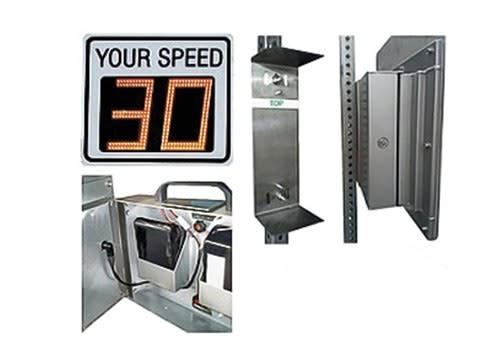
Radarsign's TC-400 is a portable battery-powered radar speed sign weighing only 20 pounds. With multiple mounting brackets, officers can move and secure the sign to different pole locations without tools. And you can use this sign in places that a trailer would never fit. The TC-400 is easily readable up to 400 feet away and is ideal for 5 to 35 mph speed limit roads. An Android app is also available. www.radarsign.com
RU2 Systems
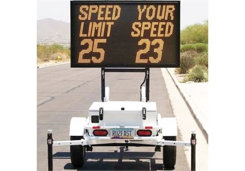
The RU2 Fast-3350 VMS Series Speed Display Trailer has a 30 x 50-inch full graphic, medium density LED array capable for 1 to 3 lines of text, full graphic characters, and complex animation. The variable message sign display folds down, creating a lower trailer profile for easy transport and storage. Standard features include high-speed blanking, flashing digit violator alert and traffic management arrows, a basic VMS message library, and customization software for both text and animation. www.ru2systems.com
Stalker Radar
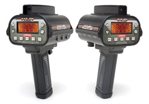
Using the Stalker LIDAR XLR’s Auto Obstruction mode, targets that are partially obscured by objects such as bushes or fences can be automatically tracked and identified. This gives the officer more location choices when setting up to monitor traffic. Stalker’s C-Thru Technology enables the LIDAR XLR to 'learn' where these obstructions are in its beam and track the target through these interruptions in its reflected signal. An ergonomic design, the light weight of 2.3 pounds, and a Heads-Up-Display (HUD) make the XLR LIDAR comfortable and easy to use. www.stalkerradar.com
Vitronic
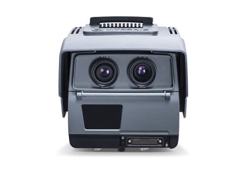
Vitronic's PoliScan FM1, for fixed and mobile deployment, uses advanced lidar tracking technology to continuously monitor up to six lanes, creating a real-time image of the traffic situation. It can detect speeding (both spot and point-to-point measurements), red light offenses, tailgating, and the illegal use of individual lanes simultaneously and from one site. For speed enforcement, it can be deployed both in fixed and mobile operation. Operators can simply detach the unit from a fixed housing and install it in a patrol car or on a tripod without the need for any additional casings or racks. Once set up, it does not require an operator. www.vitronic.com/traffic-technology
More Technology

A police agency's guide to data-driven fleet management
Costs are rising and the public expects more transparency into how their tax dollars are spent. This e-book shows how police agencies can use fleet data to take control of fleet expenses while improving officer safety and demonstrating fiscal responsibility to the communities they serve.
Read More →
AI and analytics for law enforcement: Turning data into insights
Law enforcement agencies are managing more video, sensor data and digital evidence than ever before. Discover how AI and analytics can help turn that data into actionable insights that strengthen situational awareness, accelerate investigations and support more informed decisions.
Read More →
Vasco Electronics Adds Automatic Language Detection to Vasco Translator Q1
Vasco Electronics’ software update introduces hands-free language switching and expanded offline translation across 45 language pairs, empowering law enforcement, healthcare, and front-office enterprise teams
Read More →

North Miami Police Department Deploys Mark43
The North Miami Police Department has deployed Mark43 as part of its Five-Year Strategic Plan that represents its collective vision and goals for a more proactive police department, anchored by a core commitment to leveraging modern technology to enhance efficiency and public safety.
Read More →
Cellebrite Genesis for Enterprise Now Generally Available
Made available to the public sector in June, Cellebrite Genesis is serving a growing mix of national, regional, and local agencies worldwide, including some of the largest regional and metropolitan police departments. It is now available for enterprise organizations.
Read More →
2026 Vision FirstNet Users Summit to Host Emerging Leaders Training on Grassroots Advocacy for Public Safety
“Emerging Leaders Training: Understanding the Importance of Grassroots Advocacy for Public Safety," a session during the 2026 Vision FirstNet Users Summit, will offer a roadmap for unified advocacy at the federal level.
Read More →
Motorola Solutions Completes Acquisition of D-Fend Solutions
Motorola Solutions has acquired D-Fend Solutions, an industry leader in counter-drone technology. This deal provides public safety and enterprise customers with access to advanced counter-unmanned aerial systems.
Read More →
ZeroEyes, Advantech & Camden Police Partner to Bring AI Gun Detection Technology to Delaware School District
ZeroEyes has partnered with Advantech and the Camden Police Department to deploy ZeroEyes’ AI gun detection and intelligent situational awareness platform at Delaware’s Caesar Rodney School District (CRSD).
Read More →
Leonardo U.S. Cyber & Security Solutions Introduces SignalTrace, the Next Evolution in Electronic Signature Detection Technology
SignalTrace reflects years of product refinement and a clearer expression of the technology’s purpose of recognizing and correlating electronic signatures in publicly broadcast wireless signals to reveal patterns, relationships, and trends that might otherwise go undetected.
Read More →
Pimloc Launches Secure File Sharing to Streamline Release of Redacted Video
Pimloc’s Secure File Sharing lets organizations deliver redacted video, audio, and documents through expiring, passcode-protected links, accelerating delivery while reducing security, compliance, and chain-of-custody risks.
Read More →