

First Look: Skydio’s Drone Traffic Controller
Skydio’s DFR Command software helps law enforcement agencies set up, operate, and manage drones for first response.
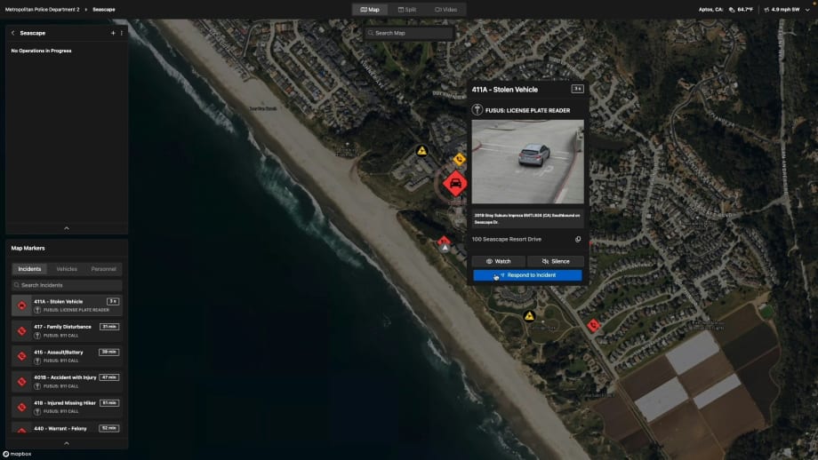
Skydio's DFR Command allows DFR teams to access images from license plate recognition systems.
Skydio
Early adopters of drone as first responder programs had to Frankenstein together the technologies needed to conduct DFR operations, often with each piece of the system produced by a different vendor.
That’s now changing as Skydio is offering a complete DFR solution, including X10 drones, drone docks, and new drone management software called DFR Command.
Noreen Charlton, Skydio’s senior manager of public safety strategy, says DFR Command was developed based on Skydio’s experience working with more than 500 public safety agencies and from the experience of the former law enforcement professionals who work at the company. Charlton is one of those law enforcement professionals. She served more than 10 years as a crime scene analyst for the Las Vegas Metropolitan Police Department where she first became interested in drones as a platform for capturing images of crime scenes.
What the team at Skydio decided to do with DFR Command was to create a tool that can facilitate the management of all aspects of DFR operations. This means it lets users control their drones, set up their drones to respond autonomously to specific types of calls and events, see critical information about the drones, and stream video feeds from the drones on multiple devices.
DFR Command even helps agencies plan where to deploy their drones for the most effective response. “We have developed this simulation algorithm to help agencies figure out where to put the docks to help them respond to 90% of their high-priority calls within two minutes,” Charlton says. The simulation determines the best places to put the docks using historical call-for-service data, she explains.

DFR Command integrates with Fusus' real time crime center software for greater situational awareness.
Skydio
DFR Command integrates with a wide variety of law enforcement technologies, including computer-aided dispatch systems, real-time crime center solutions, license plate readers, and gunshot detection tools, just to name a few. “Any system that can potentially trigger a call for service can integrate with DFR Command,” Charlton says. “The idea is to get the drone to the scene as quickly as possible and to eliminate the whole literal game of ‘telephone’ that happens when someone calls 911.”
The software not only shows the DFR team the location of the nearest drone, it also lets them know if it’s ready for the mission. “It will tell you the battery life on the drone, how far it is from the scene, and how long it will take the drone to get there,” Charlton says.
The capabilities of DFR Command also enhance officer safety. “Our partnership with Axon enables body-worn camera locations to populate in DFR Command,” Charlton explains. “The pilot can see the locations of officers who have activated their body cameras on the map, and it can tell the nearest drone to fly to the scene where an officer is not responding to dispatch. Multiple officers can then access the drone video and see if that officer’s OK of if they need additional help.”
Even if officers are carrying drones in their vehicles, DFR Command allows them to be remotely piloted by the pilots who operate the DFR drones. “If an officer is carrying a drone in the trunk of their vehicle, they can launch it, and the DFR pilot can take control,” Charlton says.
The development of DFR Command now means that Skydio can supply agencies with everything they need for a DFR program, including the X10 drone, the dock, and software for controlling and managing all of the assets, Charlton says. “We also offer training and regulatory assistance to help you build out a program that meets your needs and the needs of your community,” she adds.
More Technology

Pimloc Launches Secure File Sharing to Streamline Release of Redacted Video
Pimloc’s Secure File Sharing lets organizations deliver redacted video, audio, and documents through expiring, passcode-protected links, accelerating delivery while reducing security, compliance, and chain-of-custody risks.
Read More →
2026 Vision FirstNet Users Summit to Explore How FirstNet Fusion and LMR Are Redefining Mission-Critical Communications
One of the sessions at the 2026 Vision FirstNet Users Summit will highlight hybrid devices bridging broadband and LMR. “Bridging Broadband and LMR: FirstNet Fusion and the Rise of Hybrid Devices” will explore how public safety agencies can modernize their communications environments while maintaining the reliability of land mobile radio.
Read More →
Cellebrite Expands Exclusive SkySafe Partnership to Deliver Immediate Drone Detection and Airspace Intelligence for Digital Investigations at Scale
By integrating SkySafe's drone detection and airspace intelligence with Cellebrite's platform, agencies can connect real-time and historical UAV flight data with mobile forensic evidence, all in one place.
Read More →

New DroneShield Report Reveals Serious Gaps in Airport, Critical Infrastructure Counter-Drone Security
Survey results, as part of “Airspace Under Pressure: A Global Assessment of Counter-UAS Readiness Across Airports and Critical Infrastructure,” indicate that 60% of organizations say they lack legal authority to act against unauthorized drones.
Read More →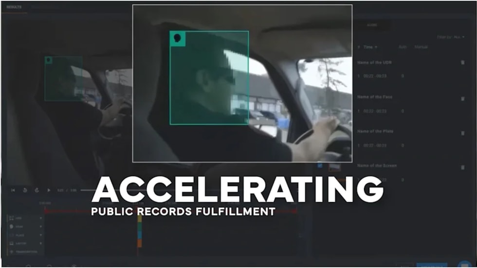
CHP to Accelerate Evidence Redaction & Public Records Fulfillment Through Veritone Redact
With Veritone Redact, the California Highway Patrol can redact video, audio, and image-based evidence, reducing time spent on evidence preparation and public record requests.
Read More →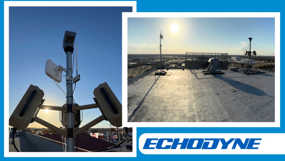
Echodyne Expands Public Safety Radar Applications Through Partnership with Axon
Echodyne has partnered with Axon to support safer and more scalable drone operations across law enforcement, homeland security, and Drone as First Responder programs globally.
Read More →
Miami Police Department Deploys Airwayz’s Overwatch Platform During FIFA World Cup Events
The deployment of Airwayz’s Overwatch airspace management platform during the FIFA World Cup demonstrates the future of airspace infrastructure for managing, securing, and coordinating complex urban airspace environments.
Read More →
How Patrolfinder Uses Data to Make Streets Safer
Law enforcement agencies have long relied on instinct and routine to optimize patrols. Patrolfinder uses data to help agencies see where officers go — and where they don’t — to improve visibility and maximize coverage.
Read More →
Crime Prevention by Merging Tech with Human Intervention
Elite Interactive Solutions tackles crime prevention with technology and human intervention, working closely with local police to provide insights when a response is needed. The key is to blend the latest in remote video monitoring, artificial intelligence, and a well-trained agent with eyes on the scene.
Read More →
Case Study Details Integration of Body-Worn Cameras with CAD
The Billerica Police Department (Massachusetts) improved transparency and accountability, sharpened evidence management, and reduced manual hours by integrating Axis Communications body-worn cameras with its Computer-Aided Dispatch (CAD) system.
Read More →