
Police Magazine

Loading data...
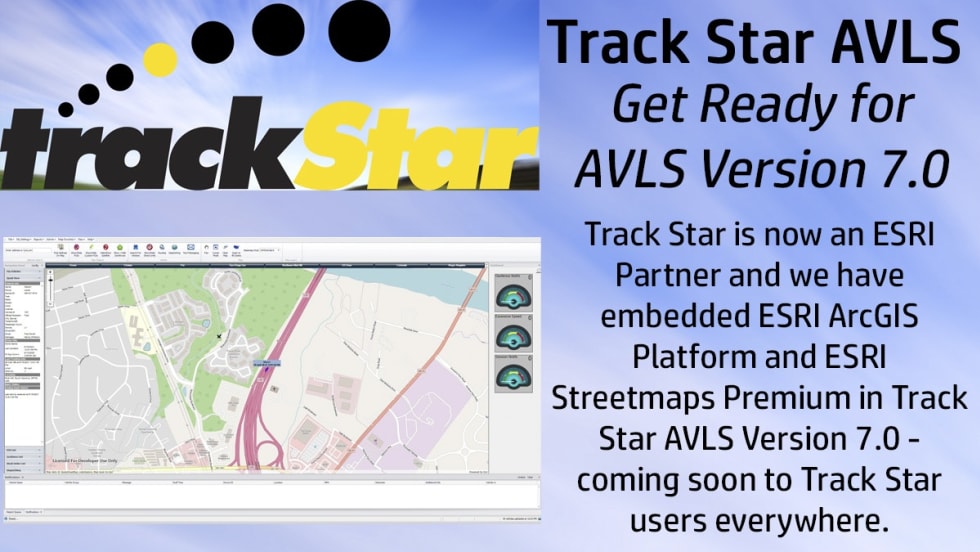
Track Star, now an ESRI Partner, is building AVLS Version 7.0 around ESRI’s ArcGIS Platform and Streetmaps Premium products.
Read More →
Engage and educate while saving time, money, and lives with GIS.
Read More →
Curious about what mobility means in public safety? Check out this expert interview and find out what it means for law enforcement agencies and fire departments throughout the US.
Read More →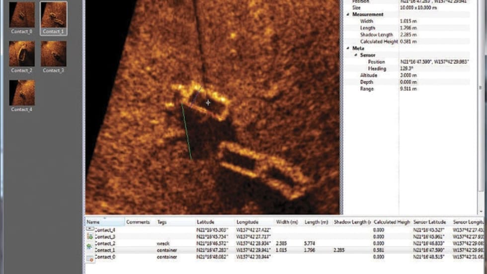
SAMM is Oceanic Imaging Consultants' Stand Alone Mosaicking Module, ideal for underwater search and survey.
Read More →
Geographic information systems (GIS) has changed the way law enforcement fights crime. American Sentinel University's GIS program is designed to teach officers the tools they need to map and analyze crime patterns.
Read More →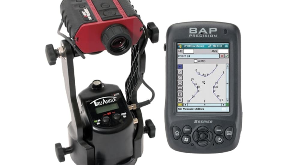
Laser Technology added new components to its mapping package for crash scene investigations that includes an LTI TruPulse 200X laser, BAP data collector, and TruAngle device.
Read More →The DriveTimes app allows officers to update traffic messages on All Traffic Solutions' traffic signs, including the time to destination and alternate routes.
Read More →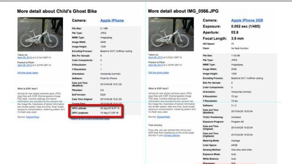
Within most digital pictures, cameras store meta data called EXIF (Exchangeable Image File Format) within the header of the file. This data can give you major clues about the origin of the photo.
Read More →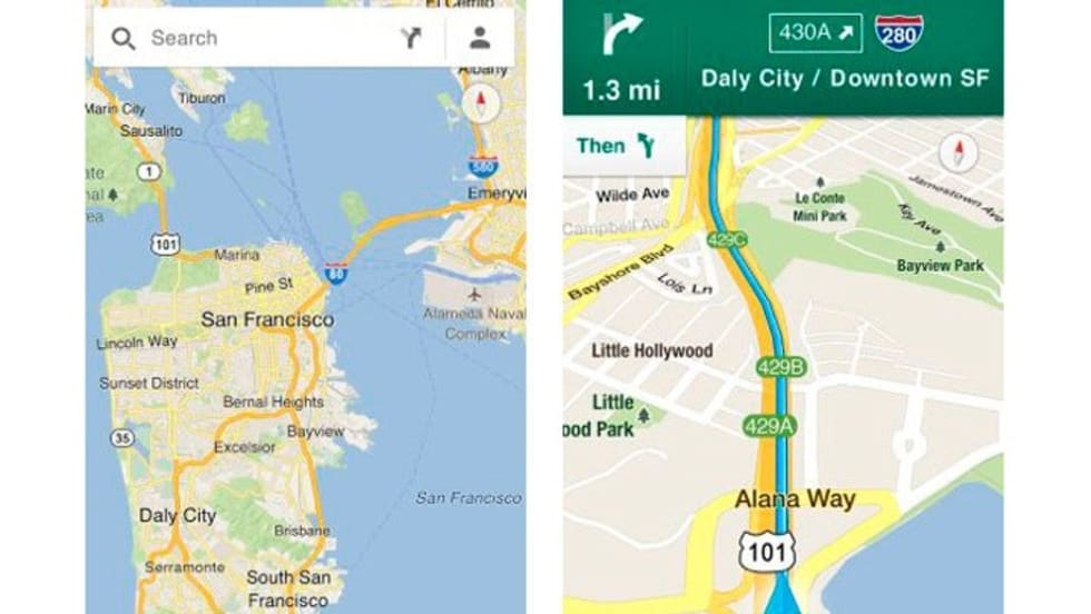
For officers who aren't issued patrol vehicles equipped with GPS for positioning and call routing, Google Maps offers a very useful alternative. GPS will always be the best choice, but it's more costly, making Google Maps a tool that's within easy reach.
Read More →Esri announced a partnership to incorporate Geofeedia's social media tools into its ArcGIS mapping platform to assist law enforcement during emergency events. The upgrade will give public safety professionals the capability to accurately integrate, monitor, analyze, and visualize live emergency data as events unfold.
Read More →