

MultiVision USA Oblique Imagery Software
MultiVision USA utilizes an advanced aerial imaging system to acquire high-resolution oblique imagery to provide multi-perspective and 3D viewing and modeling capabilities. MultiVision software provides onscreen tools to measure vertical and horizontal structures, such as building facades, backyard patios, and terrain features, from any angle or direction in the imagery.
MultiVision USA utilizes an advanced aerial imaging system to acquire high-resolution oblique imagery to provide multi-perspective and 3D viewing and modeling capabilities. MultiVision software provides onscreen tools to measure vertical and horizontal structures, such as building facades, backyard patios, and terrain features, from any angle or direction in the imagery. The software works directly with all GIS-based applications—including Computer-Aided Dispatch—allowing for the importing and exporting of additional data layers without third-party software.
More Products
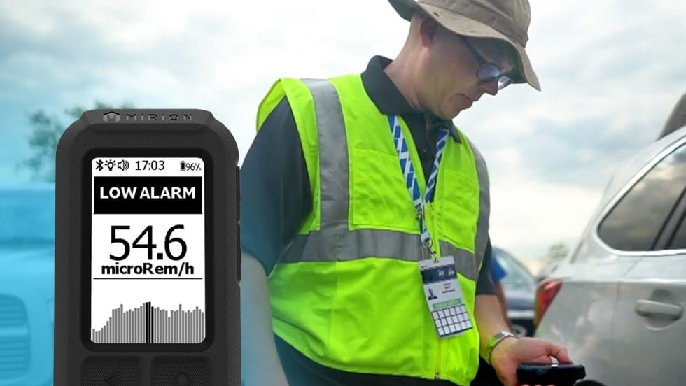
AccuRad PRD
From event security, to search and rescue, to border patrol and beyond, the AccuRad PRD offers the next generation in radiation detection.
Read More →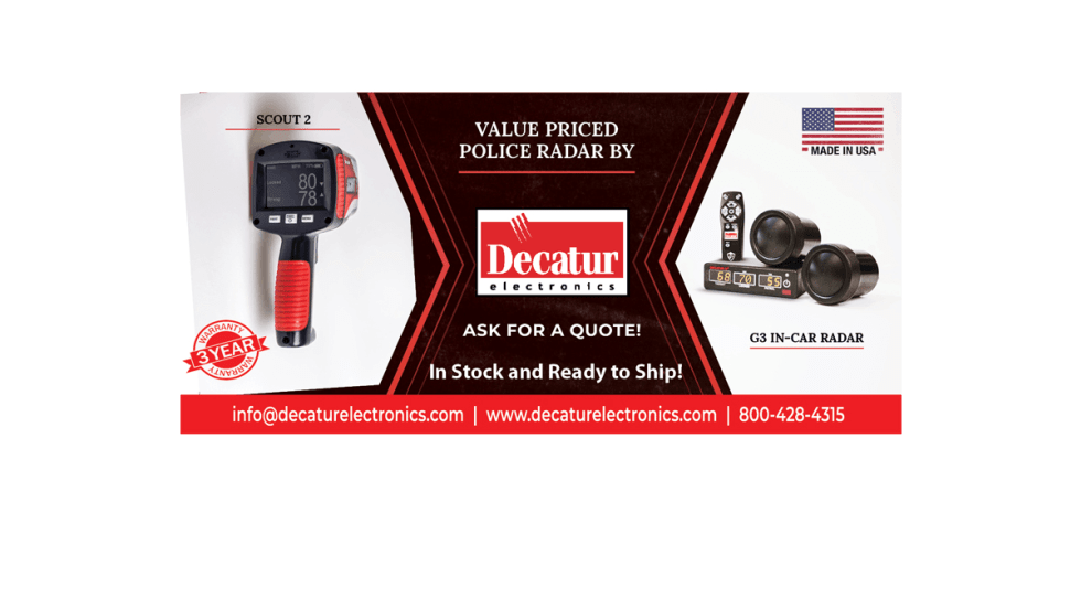
Scout 2
Decatur Electronics’ latest handheld radar, the Scout 2, offers the law enforcement profession advanced features at an economical price.
Read More →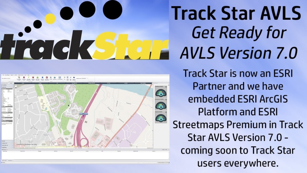
Track Star AVLS Version 7.0
Track Star, now an ESRI Partner, is building AVLS Version 7.0 around ESRI’s ArcGIS Platform and Streetmaps Premium products.
Read More →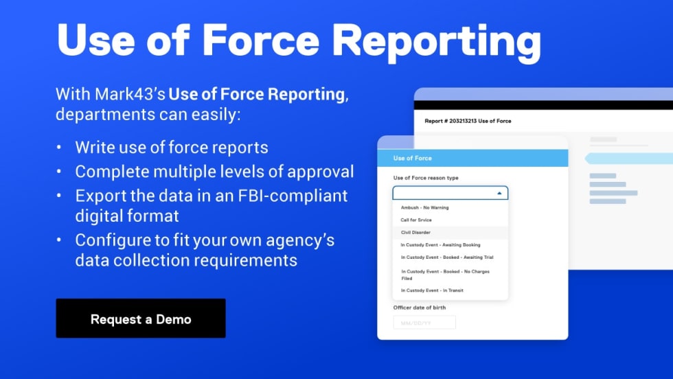
Use of Force Reporting
Mark43’s Use of Force Reporting is available as a standalone solution to support your critical responsibilities or as an integrated part of the Mark43 Public Safety Platform.
Read More →
Crash Mapper and Dashboards
Crash Mapper and Dashboards from LexisNexis Coplogic Solutions lets you aggregate, analyze, and automatically transform crash data into a force multiplier.
Read More →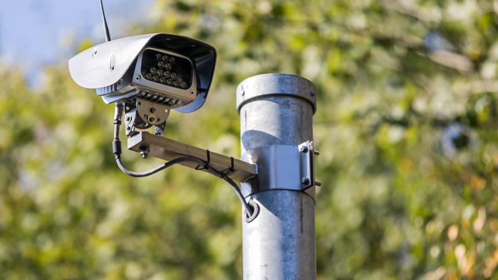
Intelligent All-in-One ALPR Camera Solution
Get hotlist alerts in under five seconds with Jenoptik´s ALPR cameras that use deep learning software and capture clear and high-resolution images even under difficult weather conditions, at night, and in high speed traffic.
Read More →Genetec Security Center
Our new e-book explains how a unified platform brings everyday matters into view through a single intuitive interface designed to simplify operations, increase response times, eliminate false alarms, and reduce maintenance and costs.
Read More →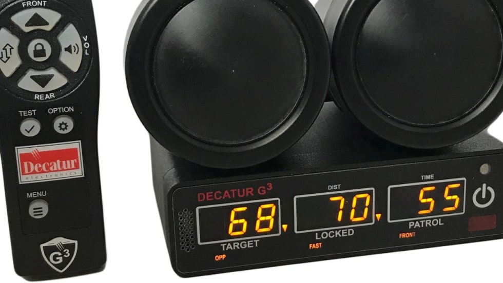
Decatur G3
The G3 by Decatur Electronics is the most competitively priced police radar in the market. It is loaded with fundamental, easy-to-use features.
Read More →CAD-to-CAD: A Nation-wide Virtual Response Network
CentralSquare’s CAD-to-CAD is an interoperable, cross-jurisdictional tool that connects public safety agencies.
Read More →
CJIS Compliance App
The app steps employees and vendors through the compliance process, provides real-time visibility, and keeps you ready for audits on an ongoing basis.
Read More →