

My Technology Can...Give You Real-Time Aerial Visibility
Cape's Aerial Telepresence platform allows agencies to send drones to calls to gain valuable intelligence before officers arrive on scene.
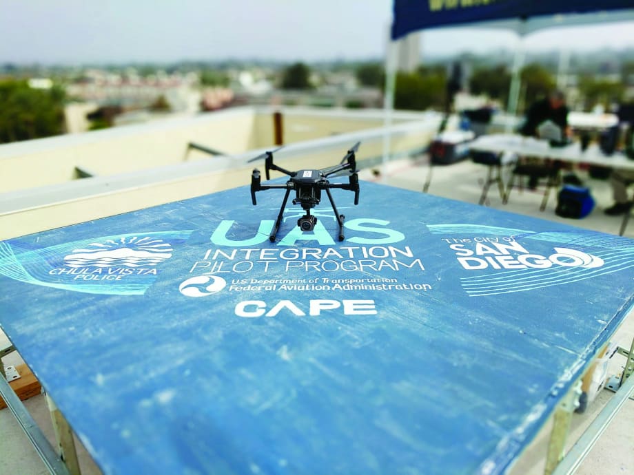
Cape's pilot program with the Chula Vista (CA) Police Department involves using drones not in the pilot's line of sight.
Photo: Cape
Drones are transforming the way public safety agencies operate and make decisions, providing increased situational awareness and real-time intelligence. As the world's first cloud software for full drone telepresence and data management, Cape (www.cape.com) enables complete remote aerial visibility, giving organizations including public safety agencies the real-time information needed to make quick and accurate decisions, and improve the safety of their officers and the communities they serve.
The Problem
In a recent study we conducted at Cape, we found that Americans have increasingly high standards when it comes to public safety agencies keeping them safe and responding to their needs. A total of 93% expect law enforcement to be present and highly visible in their communities, and 89% expect law enforcement and first responders to reach them quickly when they call for help.
Because of such increasing expectations from civilians, there is a critical need to invest in tools and technology that meet rising demands when it comes to keeping the public safe. In fact, 84% of Americans expect their local law enforcement and first responders to leverage the best technology for ensuring public safety.
However, real-time visibility has been difficult to achieve because of a variety of resource constraints. Physical limitations such as distance and terrain can make operations difficult. Additionally, agencies often lack the needed resources and internal experts vital to maintaining constant visuals on situations and are forced to do more with less, potentially compromising safety and valuable time. With limitations on the time and money required to quickly and effectively cover needed ground, including bringing in outside resources and equipment such as helicopters for overhead visibility, there have been several challenges that put agencies in a tight spot when the right resources and support are needed most.
Beyond physical and resource constraints, a lack of aerial visibility puts first responders at risk in potentially dangerous situations. Emergency calls are made during traumatic situations, meaning callers provide limited detail and insight into what's happening at the scene. With such little insight, it's difficult to determine which situations require additional response, or the best resources to deploy until it's too late. Without real-time visibility, first responders are left walking into unknown situations without a clear picture of present dangers or how to best approach the situation.
Additionally, while community concerns have presented challenges in the past, our research shows Americans are ready to embrace drones as a tool for public safety. Over 70% of consumers support the use of drones by law enforcement in their community and 62% explicitly say they would feel safer if local first responders used drones to protect their communities.
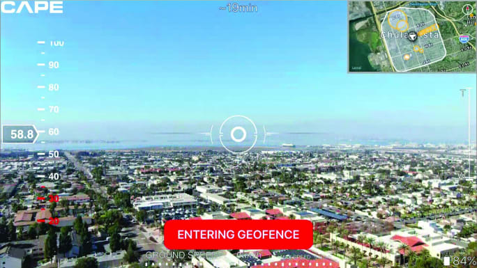
Law enforcement agencies can use Cape's cloud platform to transmit aerial views of a scene from the drone to officers at other locations.
Photo: Cape
The Solution
Cape is the leading cloud platform for drone telepresence and data management. The Cape Aerial Telepresence platform gives agencies a safe, easy, and secure tool for enabling aerial visibility and intelligence. Using Cape-enabled drones, not only is full aerial visibility possible, but deployment is fast, easy, and safe. The Cape Aerial Telepresence software easily integrates with off-the-shelf drone hardware and comes equipped with safeguards such as user-defined automation and geofencing built into the platform to ensure easy and safe operations.
Once the drone is in flight, users can log into the platform on any connected device such as smartphones and tablets and take full control of the drone to capture high-resolution video and 4K quality images. Additionally, users can also remotely and simultaneously view the live stream in real time with up to 50 authorized users using industry-best low latency.
Through the Cape Cloud, the Cape Aerial Telepresence platform easily integrates with both existing applications like CAD systems and additional drone hardware to give agencies 360-degree visibility and intelligence, which enables faster and more data-driven decisions. Data such as flight history and paths flown, drone IDs for maintenance records, and collected images and video are easily and securely stored on private portals through the Cape Cloud, giving officers the ability to save and review data to collect additional insights and learnings. The Cape Cloud offers the same level of security protocols used for activities like online banking and the portals are never exposed to external networks, ensuring all data collected is easy to access by authorized users while also remaining private and secure.
Using Cape-enabled drones, agencies can quickly get eyes on situations, better respond with the right resources, and reduce response times. Through aerial intelligence, internal experts can easily access the platform and, in real time, see the situation at hand, share tactical and situational awareness with responding officers, and make quick and accurate decisions regardless of whether they're in the field or not. Additionally, with constant eyes on situations, agencies can accurately and efficiently deploy the right resources when responding and can even help clear calls for service and keep ground units free for higher priority calls. For assisting officers and first responders, aerial visualization and real-time data can significantly improve situational awareness, helping better address situations, improve outcomes, identify criminals, support victims, and ultimately save lives.
Case Study
In October 2018 as part of the San Diego Unmanned Aircraft Systems (UAS) Integration Pilot Program (IPP), the Chula Vista Police Department and Cape launched the nation's first Drone as a First Responder program, integrating drones equipped with Cape Aerial Telepresence technology into daily emergency response operations.
Traditionally, teams leveraged drones in much more limited and one-off situations—where designated drone officers drive a car to the location, launch and navigate a single drone relaying information via phone or radio to the responding teams or commanding officers. Today, the Chula Vista PD and Cape are pioneering a totally new approach and unlocking the full potential of drones for public safety agencies with their Drone as a First Responder program proactively leveraging Cape-enabled drones as true first responders for emergency situations.
Since the debut of the Drone as a First Responder program (DFR), drones equipped with the Cape Aerial Telepresence platform have been dispatched to high-priority calls in close proximity to the CVPD's headquarters, which is one of the heaviest call zones in the city. After launching the drone from the roof of police headquarters to the scene, the designated pilot in the command center can control and manipulate the drone in order to gain the exact visibility needed. With the drone typically arriving on the scene well before responding officers, the command center can better identify and dispatch needed resources to the scene. Responding officers can also view the live stream en route to the scene, giving them full visibility of the situation they are walking into.
For CVPD, the drones have been critical to increasing situational awareness, the safety of officers, and the safety of the surrounding community. In just five months of active drone deployment, CVPD has integrated the drones into daily emergency response operations, and has flown 322 flights to date. The drone has contributed to 44 arrests.
As a testament to Cape's and CVPD's success with the DFR program, the Federal Aviation Administration (FAA) has granted the first public safety Certificate of Authorization (COA) with Beyond Visual Line of Sight (BVLOS) provision for an Integrated Pilot Program that will allow for proactive emergency response. The provision promises to drastically increase the level of success in Chula Vista, and lay the groundwork for future drone integration into public safety operation.
For more information about Cape, visit www.cape.com.
Chris Rittler is CEO of Cape.
More Technology

2026 Vision FirstNet Users Summit to Explore How FirstNet Fusion and LMR Are Redefining Mission-Critical Communications
One of the sessions at the 2026 Vision FirstNet Users Summit will highlight hybrid devices bridging broadband and LMR. “Bridging Broadband and LMR: FirstNet Fusion and the Rise of Hybrid Devices” will explore how public safety agencies can modernize their communications environments while maintaining the reliability of land mobile radio.
Read More →
Cellebrite Expands Exclusive SkySafe Partnership to Deliver Immediate Drone Detection and Airspace Intelligence for Digital Investigations at Scale
By integrating SkySafe's drone detection and airspace intelligence with Cellebrite's platform, agencies can connect real-time and historical UAV flight data with mobile forensic evidence, all in one place.
Read More →
New DroneShield Report Reveals Serious Gaps in Airport, Critical Infrastructure Counter-Drone Security
Survey results, as part of “Airspace Under Pressure: A Global Assessment of Counter-UAS Readiness Across Airports and Critical Infrastructure,” indicate that 60% of organizations say they lack legal authority to act against unauthorized drones.
Read More →
CHP to Accelerate Evidence Redaction & Public Records Fulfillment Through Veritone Redact
With Veritone Redact, the California Highway Patrol can redact video, audio, and image-based evidence, reducing time spent on evidence preparation and public record requests.
Read More →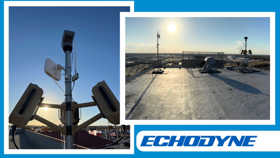
Echodyne Expands Public Safety Radar Applications Through Partnership with Axon
Echodyne has partnered with Axon to support safer and more scalable drone operations across law enforcement, homeland security, and Drone as First Responder programs globally.
Read More →
Miami Police Department Deploys Airwayz’s Overwatch Platform During FIFA World Cup Events
The deployment of Airwayz’s Overwatch airspace management platform during the FIFA World Cup demonstrates the future of airspace infrastructure for managing, securing, and coordinating complex urban airspace environments.
Read More →
How Patrolfinder Uses Data to Make Streets Safer
Law enforcement agencies have long relied on instinct and routine to optimize patrols. Patrolfinder uses data to help agencies see where officers go — and where they don’t — to improve visibility and maximize coverage.
Read More →
Crime Prevention by Merging Tech with Human Intervention
Elite Interactive Solutions tackles crime prevention with technology and human intervention, working closely with local police to provide insights when a response is needed. The key is to blend the latest in remote video monitoring, artificial intelligence, and a well-trained agent with eyes on the scene.
Read More →
Case Study Details Integration of Body-Worn Cameras with CAD
The Billerica Police Department (Massachusetts) improved transparency and accountability, sharpened evidence management, and reduced manual hours by integrating Axis Communications body-worn cameras with its Computer-Aided Dispatch (CAD) system.
Read More →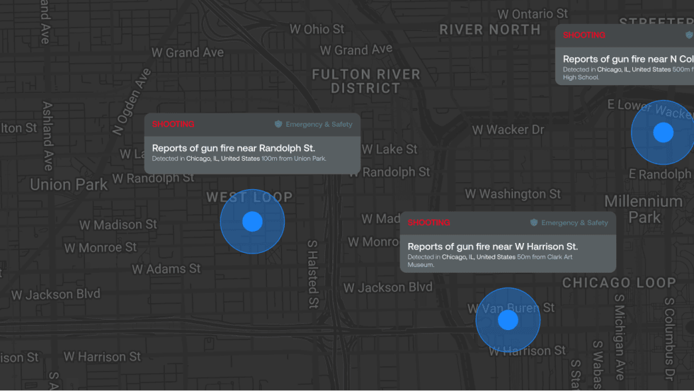
ZeroEyes Public Safety Alerts Integrates Samdesk for Real-Time Risk Detection and Awareness
ZeroEyes has integrated Samdesk into its Public Safety Alerts platform to deliver faster, verified intelligence to help organizations understand emerging risks and respond quickly.
Read More →