

App Review: First Responder Support Tools
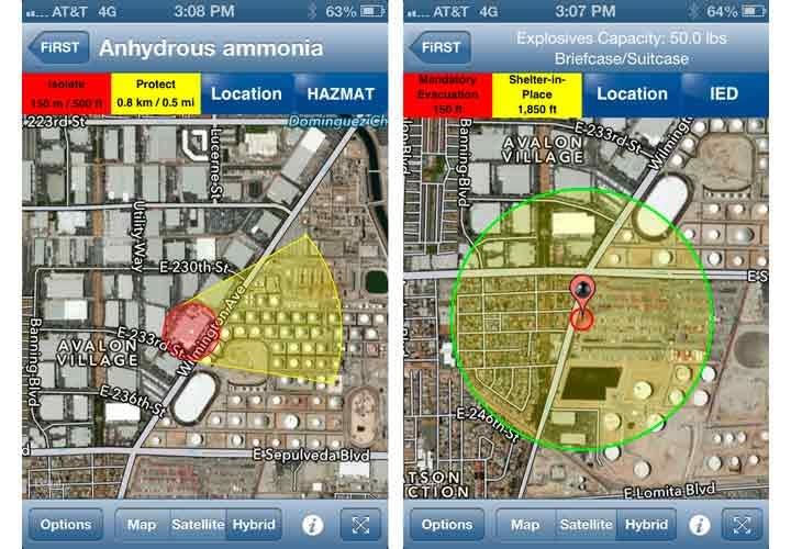
The First Responder Support Tools (FiRST) app for iOS, Android, and Windows can assist you with HazMat spill evacuation and IED standoff distances.
Screenshots via ARA Developer.
The First Responder Support Tools (FiRST) app for iOS, Android, and Windows can assist you with HazMat spill evacuation and IED standoff distances.
This easy-to-use app, developed by Applied Research Associates Inc., integrates reference data from the 2012 Emergency Response Guidebook (ERG) and is based on threat standards set by the DHS Office for Bombing Prevention and FEMA 426, Reference Manual to Mitigate Potential Terrorist Attacks Against Buildings.
The app quickly plots that data on your phone, tablet, or computer. What makes this app so useful is that is also incorporates real-time weather data when plotting potential down-wind evacuation information.
When you first launch the app, you arrive at a map screen showing your location. On this screen, place the crosshair at the incident. Next, choose either HazMat or IED. Now choose the specific incident information.
I tested IED response for a 50-pound device (right photo), and the app provided a view with location, evacuation, and shelter locations. You can easily screen-capture, and send this from nearly any device.
For the HazMat test (left photo), I plotted an anhydrous ammonia spill, and the app gave me down-wind evacuation recommendations for that time and weather. Keep in mind that as conditions change, so will your protection zones. You can enter the options area of the app to update data.
The application also allows users to view key sites and infrastructure such as schools, government facilities, and hospitals. It allows you to place roadblocks or view recommended roadblocks based on your incident. Keep in mind that if you have a phone or tablet on Wi-Fi only, you'll have to adjust location and site information accordingly.
Because of the proprietary nature of the information, only those with government credentials can view the IED data. The registration process is simple, and you receive an unlock code for the entire application.
App Review | Ratings (of 5) | ||||||||
Name | Platform | Developer | Price | Usefulness | Ease | Support | Value | Overall | |
FiRST | Android/iOS/Win. | ARA Developer | $9.99 | 5 | 5 | 4 | 3 | 4 |
George Rudenko is a senior officer and HazMat specialist with the Department of Homeland Security at the Los Angeles Seaport.
More Blog Posts

Preventing Heat Injury in Police K-9s
In the relentless heat of summer and even early fall in some parts of the country, officers face the important task of protecting their K-9 partners while working in sweltering temperatures. Recognizing changes in a dog’s behavior is the key.
Read More →
Why Your Agency Needs to Attend the ILEETA Conference
ILEETA is a complete resource for trainers to address trainers' needs. Its mission is to enhance the skills and safety of criminal justice practitioners while fostering stronger and safer communities.
Read More →
IACP 2023: New Training Products
Technologies for improving law enforcement training and training management were some of the highlights at this year's show.
Read More →
Initial Results Released from MSP 2024 Police Vehicle Testing
The 2024 pursuit-rated vehicles--all pickup trucks or SUVs, including two battery electric models the Chevrolet Blazer EV AWD and Ford Mustang Mach-E--were put through their paces.
Read More →
Officer Safety Considerations Related to Alternative-Fuel Vehicles
As more alternative-fuel and hybrid vehicles hit the road, police and other first responders need to understand that they are no more dangerous than conventional vehicles. However, there are certain safety considerations every cop should know.
Read More →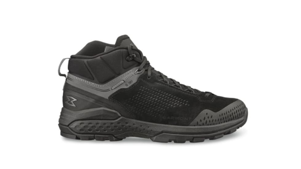
Garmont Working to Grow LE Market Presence
Garmont Tactical has found wide acceptance by military boot buyers, but now the company is trying to better respond to the needs of police officers. Many cops now are not fans of 8-inch boots, so Garmont is adapting.
Read More →
Publisher’s Note: Our Commitment to You
Through our magazine and website and our Police Technology eXchange event, we promise to provide you with information and access to resources to help you do your job safer and better.
Read More →
10 Tips for Responding to Mental Health Crisis Calls
The Harris County Sheriff's Office is a model for other agencies that want to learn about crisis intervention and mental health crisis response. Sgt. Jose Gomez shares the story of their programs and provides 10 tips for mental health crisis call response
Read More →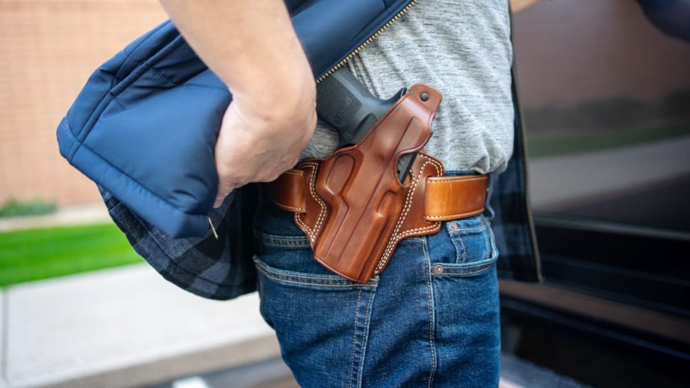
5 Things to Know When Buying Concealed-Carry or Off-Duty Holsters
Mike Barham, of Galco Holsters, shares five important considerations to keep in mind when you buy off-duty concealed or plain-clothes carry holsters.
Read More →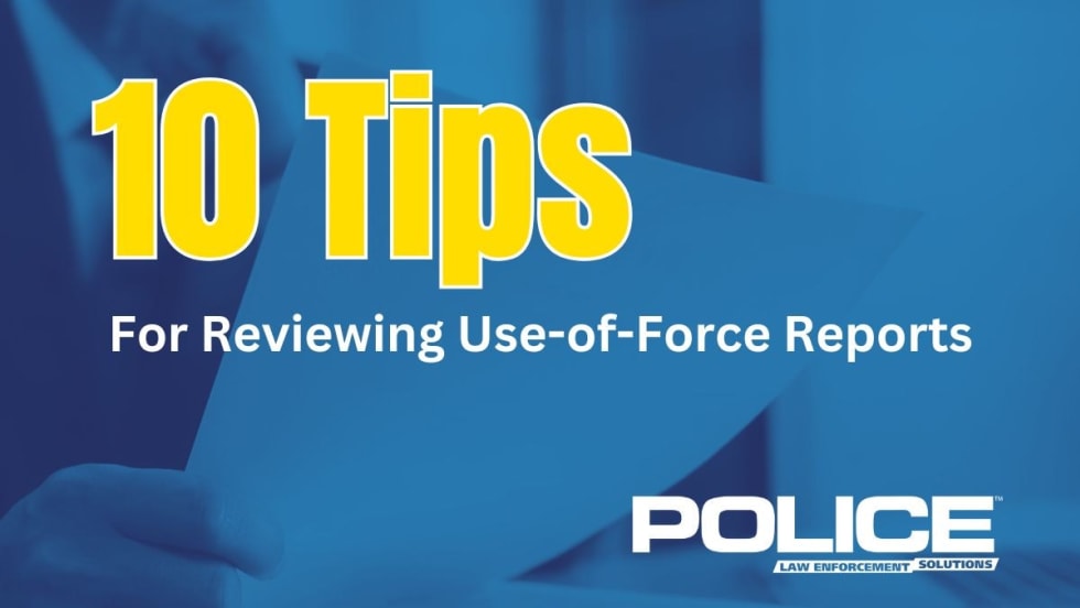
10 Tips for Reviewing Use-of-Force Reports
While the burden of accurately reporting use-of-force situations is on an individual deputy or officer, the person reviewing those reports shares in the responsibility of making sure the reporting is done properly, with clear details included.
Read More →