

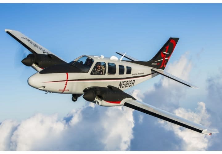
LE Planes: Flying High Cover
Planes are the unsung heroes of law enforcement air support units. While helicopters get all the glory, fixed-wing aircraft quietly fly in the background on operations, including surveillance and search and rescue.

Planes are the unsung heroes of law enforcement air support units. While helicopters get all the glory, fixed-wing aircraft quietly fly in the background on operations, including surveillance and search and rescue.
Of course, they're quiet and in the background partly because they can fly and operate at higher altitudes. Fixed-wing aircraft are stealthier by design. They can also cover more ground and stay in the air, or "on station," longer than the more recognized helicopters. This makes planes ideal for state police agencies that routinely need to travel long distances and might need to transport people or equipment by air. And new technology has enhanced these vehicles' ability to assist in operations previously limited to helicopters.
Fixed-wing aircraft are not going to replace helicopters. But they definitely serve a purpose in law enforcement, and for many missions they are the better choice.
Mission
It's more common for state police agencies to use fixed-wing aircraft because they are more suited to covering long distances, such as the span of a state, and can generally carry more people and heavier equipment, all at a lower overall cost. It depends on the mission.
Alaska has an extreme situation in which planes are police officers' main form of transportation. "Because it's so remote, because of the distance they have to travel and the area they have to cover with so few law enforcement officers, that's their primary response vehicle there," says Dan Schwarzbach, executive director and CEO of the Airborne Law Enforcement Association (ALEA). "They patrol in airplanes."
But for most agencies, fixed-wing aircraft serve more varied needs, and they're often used in conjunction with helicopters. "We use [fixed-wings] for traffic enforcement and some surveillance operations, and even for moving personnel and equipment," says Capt. Frank Peck, division commander of the Nebraska State Patrol Aviation Support Division.
Beyond determining that a mission requires a plane, which type of plane best suits an operation differs. The Texas Department of Public Safety is big enough that it owns and operates 4 Cessna 206s, 1 Cessna 208, 1 Pilatus PC-12NG Spectre, and one Twin Turbo Commander 1000.
"Our Cessna 206s and 208s are dispersed among the 15 duty stations operated by the Aircraft Operations Division," says Chief Pilot Bill Nabors of the Texas DPS. "The Pilatus is used to respond primarily to areas along the 1,254-mile Texas-Mexico border. The Twin Commander 1000 is used within the state—and at times used out of state—for the transportation of investigators and prisoners."
Surveillance
Most agencies use aircraft for surveillance; this is nothing new. But more advanced technology is allowing fixed-wing aircraft to locate people and vehicles at higher altitudes than were previously thought possible. That means that in addition to providing intel for SWAT operations and providing images of crime scenes from the air, they can find criminals, even in fields in the dark. And because they are generally faster than helicopters, fixed-wing aircraft can get to the scene more quickly.
"Before, you just wouldn't use an airplane to run patrol," says ALEA's Schwarzbach. "But the Washington State Police and California Highway Patrol, for example, have invested in the best mapping systems and cameras, and they're getting interesting results and numbers."
For example, in a recent incident a fixed-wing pilot was able to locate a driver fleeing from the California Highway Patrol in a rural area at night by using both thermal and video cameras as well as advanced mapping technology. The suspect had eluded ground efforts by turning off his headlights and hiding in a vineyard. Even so, the CHP pilot flew his plane from around seven miles away and once in the area was able to pinpoint the suspect's location at an altitude of 6,800 feet, stay with the vehicle, and direct officers on the ground to the car, where they arrested the suspect.
"With today's electronics with vector surveillance, your stand-off range can be pretty good," says Dan Keady, senior vice president of the Special Mission group at Textron Aviation, which includes Beechcraft and Cessna planes. "And as electronics get smaller, lighter, and need less power consumption, you can get them into smaller platforms."
With these improvements, almost any aircraft can benefit from high-resolution cameras as well as an area's GIS files, or a moving map, an essential tool for such operations. In the mid-1990s, Texas DPS outfitted its Cessna 210 planes with small monitors and IR cameras, but they were low resolution. "If the observer lost the target, they then lacked the situational awareness to reacquire it. It was essentially like looking through a large straw with the camera, losing the target, and then attempting to get back on the target by looking through the straw or out the window," says Nabors. "As cameras and monitors have improved, the moving map has significantly enhanced aerial law enforcement capabilities."
GIS files provide a database of street names and house numbers for a geographical location to help officers in the air determine what it is they're viewing from above. "It's like overlaying a map on top of a video picture so you know what you're seeing," says Schwarzbach. You can also import Google Earth images to see what the area looks like during the daytime while you are tracking a nighttime chase, for example.
"But it's more than that," Schwarzbach adds. "It's being able to type a location into the system and have that camera immediately slew itself over to that location and look for anomalies in that area, like a car speeding in a certain direction. At one time, because of the limitations of camera resolution and mapping technology, you couldn't do that."
Search and Rescue
GIS mapping technology also allows fixed-wing aircraft to help direct search-and-rescue efforts for disaster response, especially after a flood or landslide has made it difficult to distinguish where streets and houses are located.
Using the same technology as for surveillance, fixed-wing aircraft can locate crash victims and their vehicles, missing children, hikers, and Alzheimer's patients who have wandered off. Planes are limited in that they can't land and take off on mountaintops or in other hard-to-reach areas, but there are instances in which they are a better search option than helicopters.
"Our fixed-wing aircraft can stay on station for extended periods of time: six to seven hours as compared to 2.5 hours for the helicopter," says Texas DPS' Nabors.
This is one reason Keady of Textron says planes are especially well suited for search-and-rescue missions over large bodies of water. It may take a while to find the wreckage, the survivors, and coordinate a rescue. "You might need to fly out 150 miles, be on station for hours until you find what you're looking for, be able to drop a life raft, and then be able to get back," he says. "Not all helicopters can do that."
Beechcraft and Cessna fixed-wings can be outfitted with 360-degree search radar, infrared cameras to see bodies in the water at night, marking capability to indicate people's locations, and drop capability for deploying life rafts. The plane can take care of almost the entire operation. "Then you can vector a ship or helicopter over to pick individuals up," says Keady.
In search-and-rescue missions over land, fixed-wings serve similar functions, especially in remote areas. They can search and notify others once they've found a missing person, for example. "Each aircraft is outfitted with tracking technology to assist in the location of downed planes, missing elderly, and wayward hikers," says Nabors, speaking of the Texas DPS' three newest planes.
These aircraft are also equipped with a digital downlink to communicate with other officers in these and other operations. Many agencies still use analog systems because of cost considerations, but the newer digital downlink systems are faster and more robust. "The downlink provides a live video feed of what you're seeing," explains Peck of Nebraska State Patrol. "The commander can be in a mobile command unit and get that live perspective of what's happening, and especially for a search, it's good for the ground troops to see what's going on from the air."
Speed Enforcement
Unlike other operations that require advanced technology, using fixed-wing aircraft to identify speeders involves the relatively low-tech equipment of stop watches, calculators, and radios. It's simple and inexpensive. And planes can get a much better view of the roadways than patrol cars.
The Ohio State Police mostly use fixed-wing aircraft, especially for traffic violations on the highways, says ALEA's Schwarzbach. "That's what they expect and want from their aviation unit. So if that's the expectation, the fixed-wing platform does that all for you. It's much less expensive to own and operate than a helicopter and it's not lots of equipment. If you just want to track speeders, you can do that all day long with a plane and that's all you'll ever need."
They use a stopwatch to keep track of how long it takes for a vehicle to pass markers on the highway, which are a known distance apart. Using a simple calculation, they can determine the average speed of the vehicle. If it's too fast, they then radio to officers on the ground, who will pull the speeder over.
But it's important for an officer in the air to keep an eye on the speeder until the patrol officer makes contact with the driver, or the identity of the speeder will be difficult to defend in court. Troopers on the ground aren't taking radar readings, so the only evidence of the speeder's violation comes from the air crew's calculation and testimony.
"We give a description and we don’t take our eyes off the vehicle until the trooper is behind it and we will let them know it's the right one. You can't look away," explains Peck of the Nebraska State Patrol. "If I'm not 100% sure, we'll let it go. It's not worth getting bad case law."
Peck's agency also uses fixed-wings to provide an eye in the sky to officers in squad cars for various operations. "If a call comes up, you can get there quicker," he says. "What you see from the air might be different. If there's a really bad crash, we can tell them traffic is backed up for three miles, and let them know the best way to get to the scene."
Calculating Cost
For all their usefulness, you can't get planes unless you can pay for them and justify their cost. One point in their favor is that they aren't as expensive as helicopters. "There isn't more money available to purchase through grants or other means, but they're less costly overall," says Schwarzbach. "Planes are less expensive to use per hour, and the initial cost is less than a helicopter. As agencies look at ways to cut funding and use a less expensive platform, they will migrate," he predicts.
One thing to keep in mind, however, is the cost of equipment to use a fixed-wing to its full potential for law enforcement. The advanced cameras, thermal and high definition, and mapping systems needed to conduct surveillance and digital downlink equipment to quickly and effectively transmit video to officers on the ground don't come cheap. Schwarzbach acknowledges all of this will likely cost more than the initial investment of the aircraft itself.
"We're having customers say, 'Our budget is x. What can we do with that?'" says Textron's Keady. "We're happy to sit down with them and analyze their mission with them. We'll tell them if they can meet their mission with a plane like a C90 that's less. Therefore they have the rest of their budget to spend somewhere else."
That's one reason Beechcraft developed the Baron, Keady says. "It's a smaller, less expensive but still capable platform." Compared with the company's Caravan or King Air, the new Baron ISR plane is not pressurized, has a piston engine instead of a turbine engine, has less range, operates at lower altitudes, and is smaller with less space for equipment and passengers. But if that's all you need, it's a good option to have.
The key is determining what aircraft will best meet your agency's needs. ALEA's staff often helps law enforcement agencies sort this out and can make suggestions based on mission goals.
"Any police aircraft is a force multiplier," Capt. Peck of the Nebraska State Patrol says emphatically. "When you think of it from a law enforcement perspective, aviation assets are not a luxury, they're a necessity nowadays."
Fixed-Wing Aircraft
AgustaWestland
Beechcraft (Textron Aviation)
Cessna (Textron Aviation)
Groen Brothers Aviation
Pilatus Business Aircraft
Seabird Aviation America
More Vehicle Ops
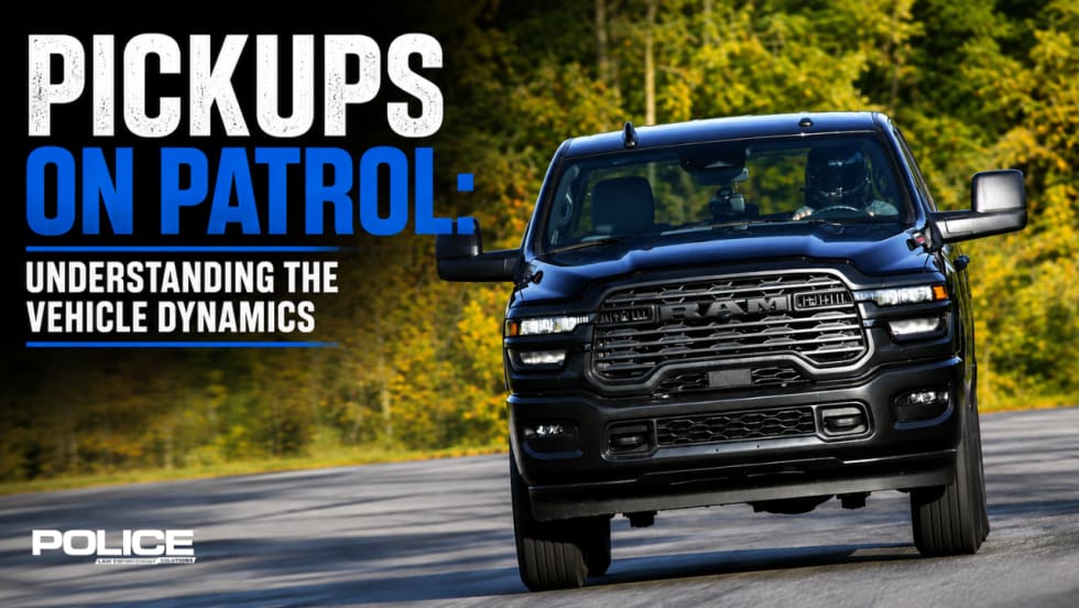
Pickups on Patrol: Understanding the Vehicle Dynamics
Pickup trucks are not new to patrol duties, but with the debut of the 2027 Ram 2500 Emergency Response Vehicle, they are getting larger and heavier. POLICE reached out to the Michigan State Police Precision Driving Unit to learn more about the pickup truck handling, vehicle dynamics, and what officers need to know.
Read More →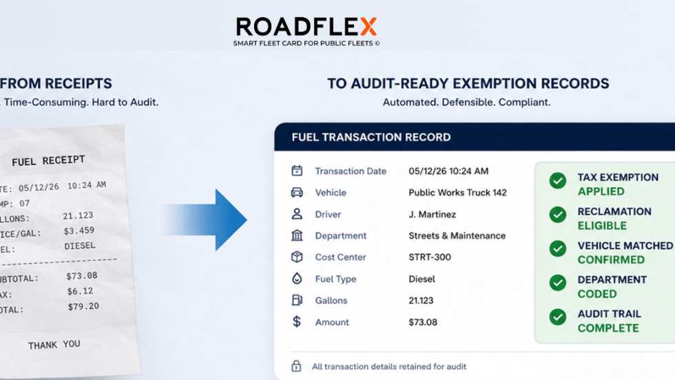
RoadFlex Brings Fuel Tax Compliance & Audit-Ready Reporting to Government Fleets
RoadFlex now offers its capabilities to help public-sector fleets streamline fuel tax exemptions, reclamation, reconciliation, and audit-ready reporting.
Read More →
Rynse Awarded Cooperative Purchasing Contract, Expanding Nationwide Fleet Wash Access for Law Enforcement
Rynse has secured a 2026-2027 NCSA contract, giving law enforcement agencies nationwide fast-track access to its fleet wash network and management platform, which streamlines procurement, reduces administrative burdens, and helps fleets stay road-ready with greater oversight.
Read More →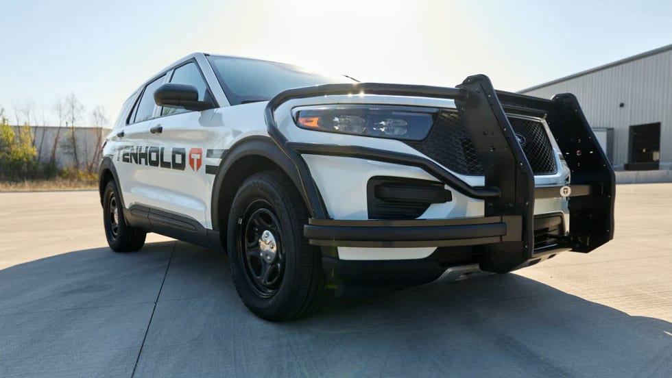
Tenhold Introduces Suppressor Gun Rack System
Tenhold, formerly Jotto Desk, provides next-generation vehicle systems for law enforcement and public safety and recently debuted its Suppressor Lock Head for its Weapon Mounting system.
Read More →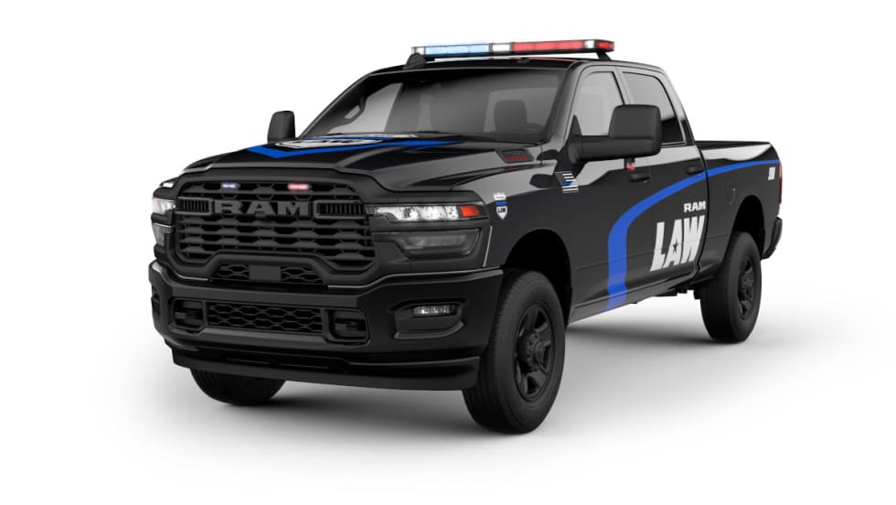
Ram Debuts Pursuit-Capable 2500 Emergency Response Vehicle
The 2027 Ram 2500 Emergency Response Vehicle is the first and only ¾-ton truck to complete the Michigan State Police vehicle trials, and Ram said it delivered outstanding performance in testing scenarios designed to replicate extreme real-world duty.
Read More →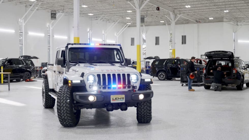
Emergency Vehicle Upfitter LEHR Opens New Facility in New Jersey
LEHR’s new centralized upfitting facility in New Jersey consolidates operations to deliver faster turnaround times and enhanced fleet capacity for law enforcement agencies across the Northeast.
Read More →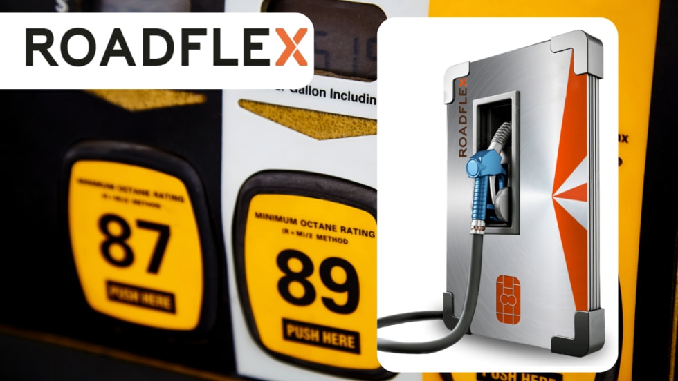
North Carolina Sheriff’s Office Improves Fueling Reliability & Operational Control
The Madison County Sheriff’s Office overcame fuel management and accounting challenges by turning to RoadFlex to improve fueling reliability, visibility, and administrative control.
Read More →
Emergency Vehicle Upfitter LEHR Expands National Footprint with New 40,000-Square-Foot Facility in Houston
LEHR has opened a 40,000-square-foot Defender Supply upfitting facility in Houston, Texas. It is expected to upfit thousands of public safety vehicles each year.
Read More →
How to Pick Your High-Risk Stop Location for Tactical Advantage
Hear veteran trainer Mike Willis, of the United States Deputy Sheriff’s Association, explain several considerations that can help you wisely pick your best spot to initiate high-risk or felony traffic stops.
Read More →
Coffee Break with Police Experts: Using Your Patrol Vehicle for Cover
In this video, hear from Dustin Mowery, a product specialist at Team Wendy, as he discusses how to best use a patrol vehicle for cover.
Read More →