

Police Magazine Logo
MenuMENU
SearchSEARCH

Technology

Products•October 1, 2008

Legal Software

SmartDraw.com has just released SmartDraw Legal Edition 2009, containing enhanced functionality and exclusive new features that help law enforcement professionals create high-impact legal graphics such as timelines, crime scene diagrams, trial graphics, accident reconstruction, evidence and flowcharts, and more in a matter of minutes.

Read More →
Products•October 1, 2008

ePolicing GIS

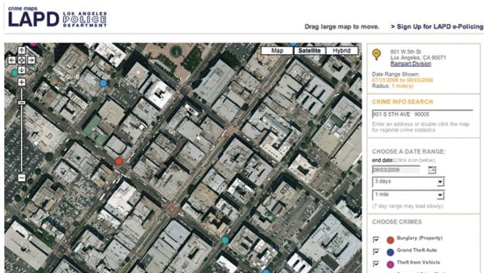
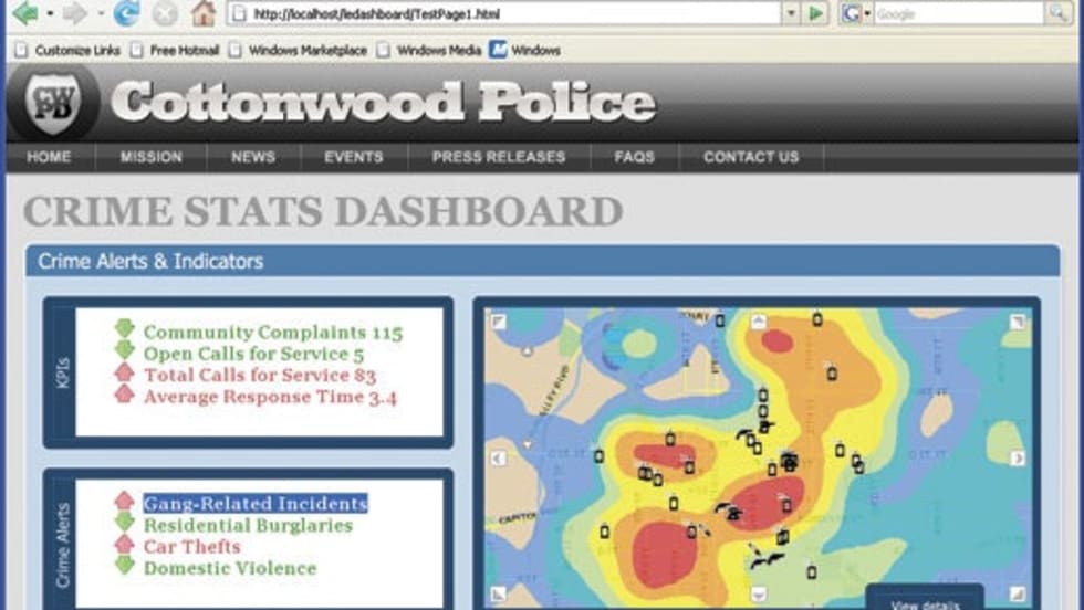
Crime Maps allows users to view updated crime activity anywhere in a police department’s jurisdiction with the new addition of satellite imagery. It is a part of a suite of applications created by ePolicing, a partnership of Los Angeles firms Lightray Productions and Psomas.

Read More →
Products•October 1, 2008

SpatialKey

GIS-based data application SpatialKey not only quickly gathers information on suspected criminal incidents and provides them immediately to responding officers, it also tracks patrol locations and monitors their travel routes and speeds, which can be altered to help save fuel and better serve the community.

Read More →
Ad Loading...
Products•October 1, 2008

Mobile Communications Solution

Spillman mobile solutions empower you to access and share information anytime, anywhere. Reliable wireless communications that are fully integrated with CAD systems promote faster response and reduce radio traffic while enabling mobile patrol to maintain safe, silent contact with base operations.

Read More →
Products•October 1, 2008

Custom Web-Based Scheduling

Scheduline uses the convenience of the Web to schedule and communicate with personnel. The secure, scalable system makes scheduling fast and easy from any computer with an internet connection. Personnel can view their own schedules online, and can view or print schedules from any screen.

Read More →
Products•October 1, 2008

ArcGIS 9.3

Whether you need to perform spatial analysis, manage large amounts of spatial data, or produce cartographically appealing maps to aid in decision making, ArcGIS allows you to use one common platform to meet all your GIS needs. And because ArcGIS is built using technology standards, it will integrate well with your existing systems.

Read More →
Ad Loading...
Articles•by Melanie Basich•October 1, 2008

Mobile Data: What's new in in-car computing?

The latest in-car computers and laptops for law enforcement.

Read More →
Articles•by David Griffith•October 1, 2008

Quick Charge Artist

The Light for Life UC3.400 is a full-size duty flashlight that charges in 90 seconds and can be charged once a day for 135 years.

Read More →
News•by Staff Writer•September 18, 2008

Fed Grant Boosts NYPD Anti-Nuke Net

Two thousand New York City officers will carry GPS-outfitted radiation detectors as part of an effort to prevent a nuclear attack on the city. The equipment is part of a $29.5 million federal homeland security grant to the NYPD announced Tuesday.

Read More →
Ad Loading...
News•by Staff Writer•September 18, 2008

LAPD Unveils New Tipster Tool: Anonymous Text Messages

Los Angeles Police Chief William J. Bratton on Wednesday unveiled a new system allowing people to provide anonymous crime tips to police through text messages and the department's website.

Read More →