

Microsoft, ESRI to Help Improve Homeland Security Operations
Microsoft Corp. and ESRI together are driving Homeland Security innovations to more effectively help protect citizens, prevent and solve crimes, and enable counter-terrorism through software. The newly formed collaboration will combine the best capabilities from both organizations in geospatial and collaborative technologies, and will result in advanced intelligence for state and local data fusion centers and emergency operations centers.
Microsoft Corp. and ESRI together are driving Homeland Security innovations to more effectively help protect citizens, prevent and solve crimes, and enable counter-terrorism through software. The newly formed collaboration will combine the best capabilities from both organizations in geospatial and collaborative technologies, and will result in advanced intelligence for state and local data fusion centers and emergency operations centers.
An intended product of this collaboration is the FusionX Appliance, a baseline IT architecture for fusion centers, which will provide users with advanced collaboration and geospatial intelligence capabilities by combining the power of ESRI's ArcGIS Server Advanced Enterprise with the collaboration capabilities of Microsoft Office SharePoint Server 2007.
FusionX will enable homeland security and law enforcement personnel to analyze previously disparate data sets in a mapping context and easily share that information in near real time with relevant stakeholders. FusionX will enhance the abilities of fusion center directors at the strategic and tactical level, enabling them to visualize patterns and trends to help prevent future acts of terrorism and crime, and facilitate a faster and more informed response when necessary.
Through the intake of raw data such as fire, police, and citizen reports, FusionX will allow for geocoding and mapping of the data to help detect man-made acts of terrorism and crime, such as organized, gang and drug-related activity. Critical GIS data is made accessible and shareable, replacing current collaborative analysis methods that rely on paper exchange and e-mail.
The IT architectural features of the appliance include the following:
Sophisticated management dashboards through the advanced monitoring, modeling, analysis and planning capabilities of ArcGIS Server and Microsoft Office PerformancePoint Server 2007
ESRI ArcGIS Server Advanced Enterprise, Microsoft Office SharePoint Server 2007, Microsoft Office PerformancePoint Server 2007, Microsoft SQL Server 2008 and access to terabytes of high-quality pre-rendered base maps and imagery
An advanced situational awareness portal with support for GeoRSS feeds, Keyhole Markup Language (KML) feeds and other data that will be integrated in the SharePoint environment for access control features and information sharing
Best practices and foundational content specific to anticipated operator and analyst requirements. Customers will be able to customize the software as necessary, but the goal is to deliver capability that is usable after only minimal configuration.
"Our police forces, sheriff departments and fusion center managers are increasingly relying on collaboration tools that help them connect the dots in a world of asymmetrical threats," said Gail Thomas-Flynn, general manager of State and Local Government at Microsoft. "Microsoft and ESRI's FusionX Appliance provides the layman- to expert-level technology that can facilitate the intake, analysis, visualization and dissemination of information to the right person, at the right time, in the right place."
The FusionX Appliance will deliver advanced geospatial and collaboration capability with minimal configuration and maximum ease of use, yet at an affordable price. It will be extensible so as to grow with the needs of an individual customer. The FusionX Appliance also will allow for the scaling of its technology architecture framework to a broader set of federal, state and local domestic security and public safety agencies with capabilities such as geoprocessing and geoanalytics.
"We understand what it takes to provide secure and mission-critical capabilities in ways that leverage the technologies that many customers already own," said Russ Johnson, public safety industry manager at ESRI. "And that is extremely important in this economic climate."
More information about the program is available at https://www.microsoft.com/industry/government/solutions/FusionX/default.aspx.
More Technology

Pimloc Launches Secure File Sharing to Streamline Release of Redacted Video
Pimloc’s Secure File Sharing lets organizations deliver redacted video, audio, and documents through expiring, passcode-protected links, accelerating delivery while reducing security, compliance, and chain-of-custody risks.
Read More →
2026 Vision FirstNet Users Summit to Explore How FirstNet Fusion and LMR Are Redefining Mission-Critical Communications
One of the sessions at the 2026 Vision FirstNet Users Summit will highlight hybrid devices bridging broadband and LMR. “Bridging Broadband and LMR: FirstNet Fusion and the Rise of Hybrid Devices” will explore how public safety agencies can modernize their communications environments while maintaining the reliability of land mobile radio.
Read More →
Cellebrite Expands Exclusive SkySafe Partnership to Deliver Immediate Drone Detection and Airspace Intelligence for Digital Investigations at Scale
By integrating SkySafe's drone detection and airspace intelligence with Cellebrite's platform, agencies can connect real-time and historical UAV flight data with mobile forensic evidence, all in one place.
Read More →

New DroneShield Report Reveals Serious Gaps in Airport, Critical Infrastructure Counter-Drone Security
Survey results, as part of “Airspace Under Pressure: A Global Assessment of Counter-UAS Readiness Across Airports and Critical Infrastructure,” indicate that 60% of organizations say they lack legal authority to act against unauthorized drones.
Read More →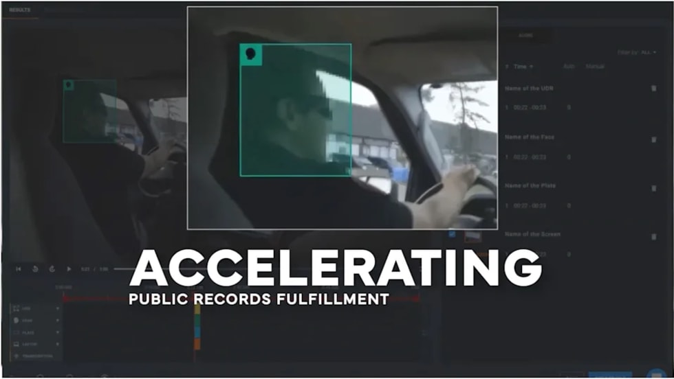
CHP to Accelerate Evidence Redaction & Public Records Fulfillment Through Veritone Redact
With Veritone Redact, the California Highway Patrol can redact video, audio, and image-based evidence, reducing time spent on evidence preparation and public record requests.
Read More →
Echodyne Expands Public Safety Radar Applications Through Partnership with Axon
Echodyne has partnered with Axon to support safer and more scalable drone operations across law enforcement, homeland security, and Drone as First Responder programs globally.
Read More →
Miami Police Department Deploys Airwayz’s Overwatch Platform During FIFA World Cup Events
The deployment of Airwayz’s Overwatch airspace management platform during the FIFA World Cup demonstrates the future of airspace infrastructure for managing, securing, and coordinating complex urban airspace environments.
Read More →
How Patrolfinder Uses Data to Make Streets Safer
Law enforcement agencies have long relied on instinct and routine to optimize patrols. Patrolfinder uses data to help agencies see where officers go — and where they don’t — to improve visibility and maximize coverage.
Read More →
Crime Prevention by Merging Tech with Human Intervention
Elite Interactive Solutions tackles crime prevention with technology and human intervention, working closely with local police to provide insights when a response is needed. The key is to blend the latest in remote video monitoring, artificial intelligence, and a well-trained agent with eyes on the scene.
Read More →
Case Study Details Integration of Body-Worn Cameras with CAD
The Billerica Police Department (Massachusetts) improved transparency and accountability, sharpened evidence management, and reduced manual hours by integrating Axis Communications body-worn cameras with its Computer-Aided Dispatch (CAD) system.
Read More →