

Drones Used to Assess L.A. Wildfire Damage, Look For Hot Spots
For the first time, the Los Angeles Fire Department used drones Thursday to help coordinate its battle against a pair of wildfires threatening homes in the city.
For the first time, the Los Angeles Fire Department used drones Thursday to help coordinate its battle against a pair of wildfires threatening homes in the city, reports the Los Angeles Daily News.
LAFD Chief Ralph Terrazas said early Thursday that drones will be used "for the first time ever," primarily to conduct property assessment as the agency surveys damage caused by the Creek fire near Sylmar and the Skirball fire in the Bel-Air and Sepulveda Pass.
"We also can look for hotspots," Terrazas said. "The drone will fly over, locate hotspots, and then we'll dispatch our firefighters to get final extinguishment in that area. So we're very, very proud of that new technology."
LAFD Public Information Officer Peter Sanders said Thursday evening that fire personnel flew two UAVs for 30 minutes into a canyon from the north end of Moraga.
"It was the first time we used them in a real scenario. We did aerial damage assessments and found some hot spots," Sanders said.
The operation was highly coordinated by the department to avoid becoming a threat to water-dropping helicopters.
More Technology

Pimloc Launches Secure File Sharing to Streamline Release of Redacted Video
Pimloc’s Secure File Sharing lets organizations deliver redacted video, audio, and documents through expiring, passcode-protected links, accelerating delivery while reducing security, compliance, and chain-of-custody risks.
Read More →
2026 Vision FirstNet Users Summit to Explore How FirstNet Fusion and LMR Are Redefining Mission-Critical Communications
One of the sessions at the 2026 Vision FirstNet Users Summit will highlight hybrid devices bridging broadband and LMR. “Bridging Broadband and LMR: FirstNet Fusion and the Rise of Hybrid Devices” will explore how public safety agencies can modernize their communications environments while maintaining the reliability of land mobile radio.
Read More →
Cellebrite Expands Exclusive SkySafe Partnership to Deliver Immediate Drone Detection and Airspace Intelligence for Digital Investigations at Scale
By integrating SkySafe's drone detection and airspace intelligence with Cellebrite's platform, agencies can connect real-time and historical UAV flight data with mobile forensic evidence, all in one place.
Read More →

New DroneShield Report Reveals Serious Gaps in Airport, Critical Infrastructure Counter-Drone Security
Survey results, as part of “Airspace Under Pressure: A Global Assessment of Counter-UAS Readiness Across Airports and Critical Infrastructure,” indicate that 60% of organizations say they lack legal authority to act against unauthorized drones.
Read More →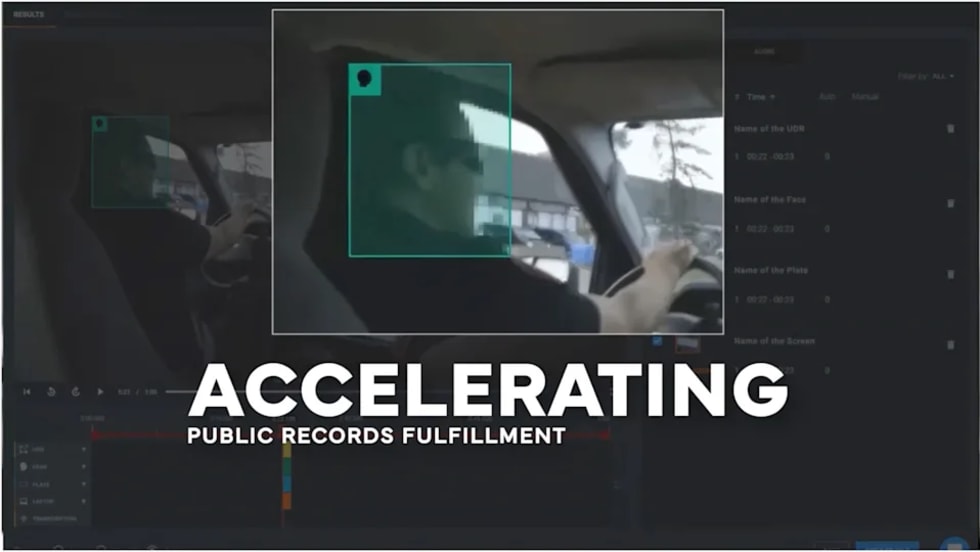
CHP to Accelerate Evidence Redaction & Public Records Fulfillment Through Veritone Redact
With Veritone Redact, the California Highway Patrol can redact video, audio, and image-based evidence, reducing time spent on evidence preparation and public record requests.
Read More →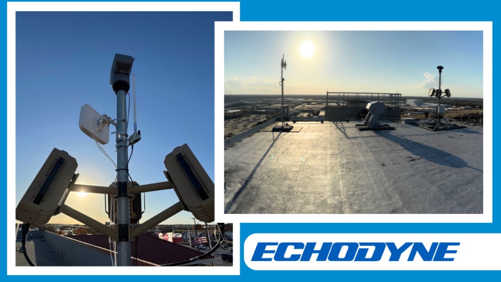
Echodyne Expands Public Safety Radar Applications Through Partnership with Axon
Echodyne has partnered with Axon to support safer and more scalable drone operations across law enforcement, homeland security, and Drone as First Responder programs globally.
Read More →
Miami Police Department Deploys Airwayz’s Overwatch Platform During FIFA World Cup Events
The deployment of Airwayz’s Overwatch airspace management platform during the FIFA World Cup demonstrates the future of airspace infrastructure for managing, securing, and coordinating complex urban airspace environments.
Read More →
How Patrolfinder Uses Data to Make Streets Safer
Law enforcement agencies have long relied on instinct and routine to optimize patrols. Patrolfinder uses data to help agencies see where officers go — and where they don’t — to improve visibility and maximize coverage.
Read More →
Crime Prevention by Merging Tech with Human Intervention
Elite Interactive Solutions tackles crime prevention with technology and human intervention, working closely with local police to provide insights when a response is needed. The key is to blend the latest in remote video monitoring, artificial intelligence, and a well-trained agent with eyes on the scene.
Read More →
Case Study Details Integration of Body-Worn Cameras with CAD
The Billerica Police Department (Massachusetts) improved transparency and accountability, sharpened evidence management, and reduced manual hours by integrating Axis Communications body-worn cameras with its Computer-Aided Dispatch (CAD) system.
Read More →